
Buy a McGill house for $1.4 million
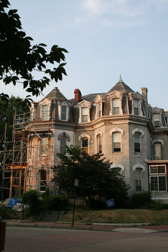
One of the original McGill houses of LeDroit Park is up for sale for $1.4 million. The Second Empire manse on Anna Cooper Circle (1901 Third St, specifically), contains seven bedrooms and 4.5 bathrooms across 3,235 sq. ft. The house is one-half of a duplex and both are pictured in the 2010 photo above (1901 is on the right).
The house’s mansard roof is a signature feature of the Second Empire style along with window moulding, ornate porches, ornate brackets, prominent eaves, and prominent cornices.
In the late 19th century, the house was the home of General William Birney, a southern abolitionist who served in the Union Army during the Civil War. After the war, Birney moved to Washington to establish a law practice. He lived in LeDroit Park for a few years and eventually retired to Montgomery County, Md.
The house previously sold for $133,636 in 1997.
Whole Foods is coming!
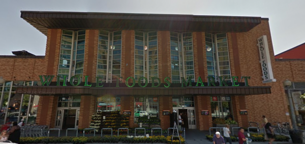
The Washington Business Journal reports that Whole Foods is slated for a new development on the parking lot at Florida and Sherman Avenues. The retailer’s arrival is typically a harbinger of soaring real estate values for surrounding neighborhoods. Whole Food is the latest iteration of potential tenants, which had before included Harris Teeter.
The Whole Foods is part of a proposed mixed-use development by developers MRP and JBG, the latter of which is finishing several development projects just a few blocks away.
The development proposal is far from final. Since the development involves the disposition of District-owned land, the DC Council will have to approve the deal.
Area residents have enjoyed a grocery renaissance over the past two years. A new Giant, the largest grocery store in DC, opened at 7th and P Streets in November 2013. A new Trader Joe’s opened at 14th and U Streets in March 2014.
Here’s an updated list of of LeDroit Park’s nearest grocery stores, as measured from Anna Cooper Circle.
| Store | Location | Distance (mi) |
|---|---|---|
| Giant | 7th & P Streets NW | 0.6 |
| Whole Foods (proposed) | Florida & Sherman Avenues NW | 0.7 |
| Trader Joe’s | 14th & U Streets NW | 0.9 |
| Safeway | 5th & L Streets NW | 0.9 |
| Harris Teeter | 1st & M Streets NE | 1.0 |
| Whole Foods | 1400 blk. P Street NW | 1.1 |
Play Pac-Man in LeDroit Park
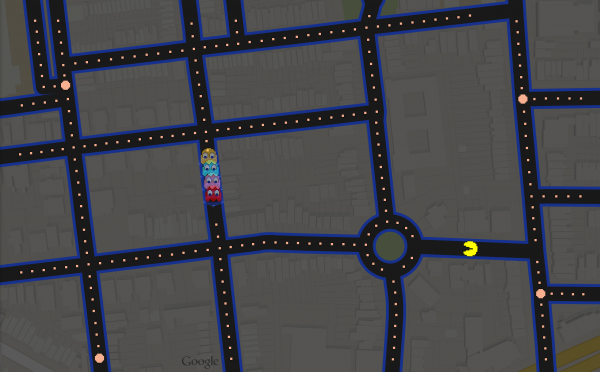
Google Maps has enabled a Pac-Man mode that turns ordinary street maps into a Pac-Man game. Click the Pac-Man box in the lower-left corner of Google Maps and you too can chomp your way around Anna Cooper Circle!
DDOT to plant 16 trees in LeDroit Park this fall

Fall is a good time to plant trees. DDOT has released its tree-planing map and LeDroit Park is slated to receive 16 trees. The agency only plants trees in public space, meaning the trees will be planted in the tree boxes or planting strips between the sidewalks and the curbs.
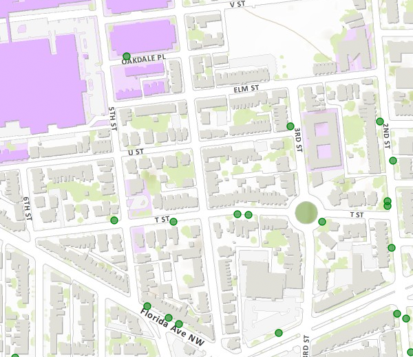
- 501 T Street
- 406 T Street
- 324 T Street
- 318 T Street
- 471 Florida Avenue
- 1934 3rd Street
- 1842 2nd Street
- Opposite 1915 2nd Street
- Opposite 1919 2nd Street
- 1948 2nd Street
- 1929 2nd Street
- 329 Rhode Island Avenue
- 455 Florida Avenue
Sweetgum (Slender Silhouette cultivar)
- 453 Florida Avenue
- Opposite 432 Oakdale Place
Cherry tree (Snow Goose cultivar)
- Southwest circumference of Anna Cooper Circle
Trader Joe’s coming to 14th & U

It looks like 2013 will be a harvest year for LeDroit Park residents as two new grocery stores open nearby. DCist broke the news that Trader Joe’s will open a store at the Louis building now under construction at the southwest corner of 14th and U.
Located at just under a mile’s walk from Anna J. Cooper Circle, the new store will provide another grocery option to area residents.
TJ’s prices are competitive with many other stores and the TJ’s specializes in unusual and somewhat exotic foods in addition to the usual staples. TJ’s main weakness lies in its produce selection, which, judging from experiences at the Trader Joe’s in the West End, is limited.
The store’s opening next year will also be accompanied by the opening of the 60,000 square-foot Giant at the CityMarket project at 7th and P Streets in Shaw. Once these two projects open, all the major grocery store chains in the area will be located no more than 1.1 mi. from LeDroit Park.
| Store | Location | Distance (mi) |
|---|---|---|
| Giant (opening 2013) | 7th & P Streets NW | 0.6 |
| Trader Joe’s (opening 2013) | 14th & U Streets NW | 0.9 |
| Safeway | 5th & L Streets NW | 0.9 |
| Harris Teeter | 1st & M Streets NE | 1.0 |
| Whole Foods | 1400 blk. P Street NW | 1.1 |
Even still I dream of a full-service grocery store opening up at the long-stalled Howard Town Center project at Georgia Avenue and V Street. The project, in the planning stages for many years, has been perpetually delayed by disagreements between Howard University and its development partner.
The UPO building on Rhode Island Avenue used to be a Safeway many years ago. The site is large enough to be redeveloped into a modern, urban grocery store if parking is placed underground. In fact the second floor could house UPO’s offices.
Until those dreams come true, the nearest full-service grocery stores are a long, but manageable walk.
What Anna Cooper Circle looked like 100 years ago

This photo, taken around 1910, shows the fire brigade on T Street just west of Anna J. Cooper Circle. The circle’s landscaping was much sparser then than it is today, but you will also notice that this was taken before the city altered 3rd Street to bisect the circle for several decades.
One will also notice the now-razed McGill house on the right side of the photo. That lot now hosts the rectangular brick apartment building that clearly never faced historic preservation review.
We haven’t been able to find any news stories explaining what exactly happened the day of the photo.
Hungry in LeDroit Park

Is LeDroit Park a “food desert”? The phrase refers to a neighborhood where the nearest grocery store is more than a mile away. First, this metric would classify many of the tony precincts of Bethesda, Potomac, and McLean as “food deserts”.
Despite that, the metric isn’t entirely useless. Distance does matter greatly to populations who, for whatever reason, do not have cars. Groceries are heavy, after all.
Even still, WAMU’s recent characterization of LeDroit Park as a food desert is incorrect. In fact, you can plug in directions from Anna J. Cooper Circle, the neighborhood’s center, to the Giant at 8th and P Streets NW.
The distance? Under a mile. That’s about 15 minutes by foot.
In fact, if you’d rather take a bus, which we frequently do with groceries, the G2 runs every 30 minutes from LeDroit Park and along P Street. It passes not only the aforementioned Giant, but also the Whole Foods on the 1400 block of P Street. If you return in under 2 hours, the round-trip bus cost is $1.50.
This grocery store is slated to close soon so a new Giant, along with housing, can be constructed on the site. After that happens, the 3-year-old Safeway at 5th and L Streets NW and the 6-month-old Harris Teeter in NoMA will vie for the title as nearest grocery store. Each is exactly 1 mile away.
Furthermore, once the Howard Town Center project takes flight, it will feature its own grocery store. The project is about a half-mile from Anna J. Cooper Circle.
So there you have it. Within 1 mile of LeDroit Park one will find a Giant, a Safeway, and a Harris Teeter. That hardly qualifies the neighborhood as a food desert.
Planting the Circle

Heuchera americana
Who maintains Anna J. Cooper Circle? Well, many people do, and you can, too!
Join your neighbors tomorrow (Friday) at 5:00 pm to help plant some heucheras (pictured above).
We also learned that a group called Community Bridge has a contract with the District to maintain small parks and that they often clean up the circle, mowing the grass and pulling weeds.
The planting, however, is a resident-driven labor of love, so any help this Friday would be greatly appreciated. Bring your shovel if you have one.
Eyes (and Feet) on the Street
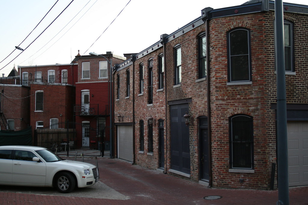
Meet your neighbors and catalog trouble spots. LeDroit Park residents will gather at Anna Cooper Circle on Thursday, April 15, for an alleyway walk-through. The purpose is to alert our ANC Commissioner Myla Moss, Councilmember Jim Graham, and our accompanying MPD officer of any inadequate lighting conditions or other features that may attract crime to our alleys.
The organizer tells us, “while the safety walk has a serious purpose, it’s also a great way to meet your neighbors and find out more about LeDroit Park.”
LeDroit Park Safety Walk
Thursday, April 15, 2010
Meet at Anna Cooper Circle at 7 pm
More Snopocalypse
“Of course, the storm is the big story, it is unbelievable. It actually paralyzed Washington more than Joe Lieberman. In fact, there was so much white powder in D.C., people thought Marion Barry was mayor again.” — Jay Leno, Dec. 21, 2009
We turned on our camera to discover a few more photos of LeDroit Park after the Snowpocalyse that ended the weekend before Christmas. Enjoy. (Click each photo to view a larger version)
* * *
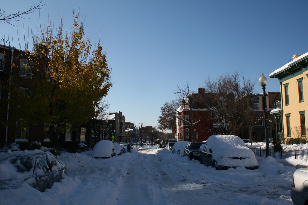
Looking south on Fourth Street:
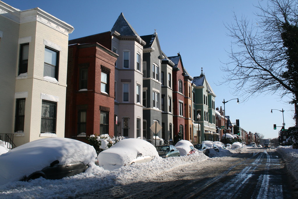
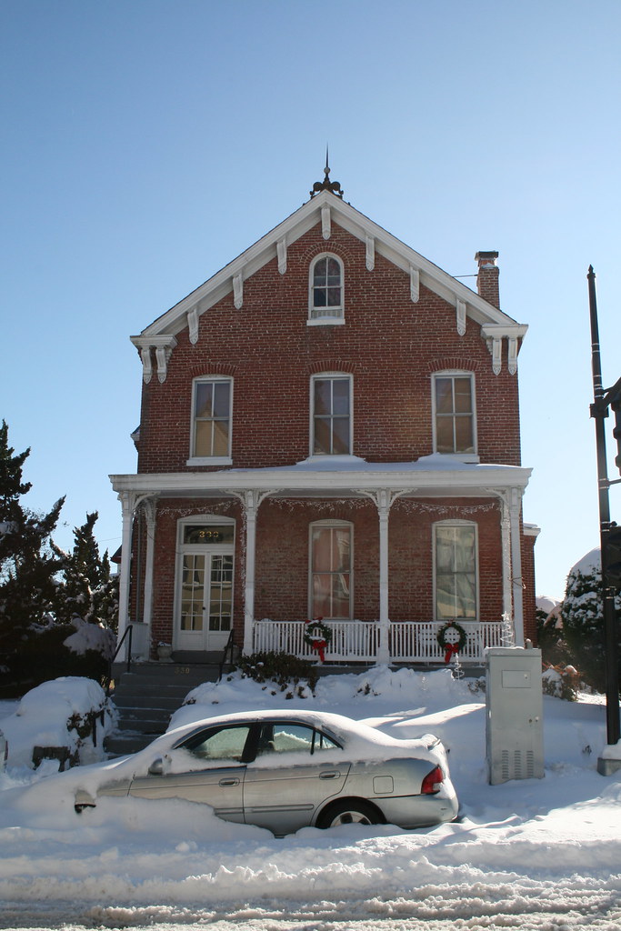
Anna J. Cooper Circle under snow:
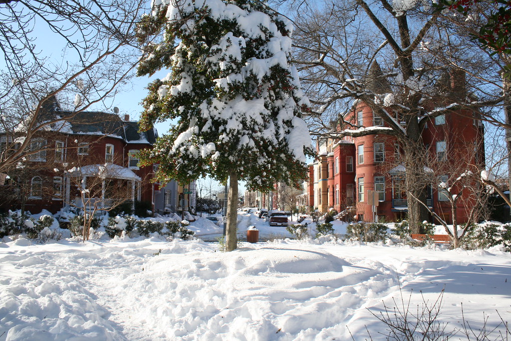

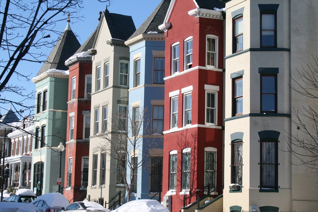
LeDroit Park’s own painted ladies:
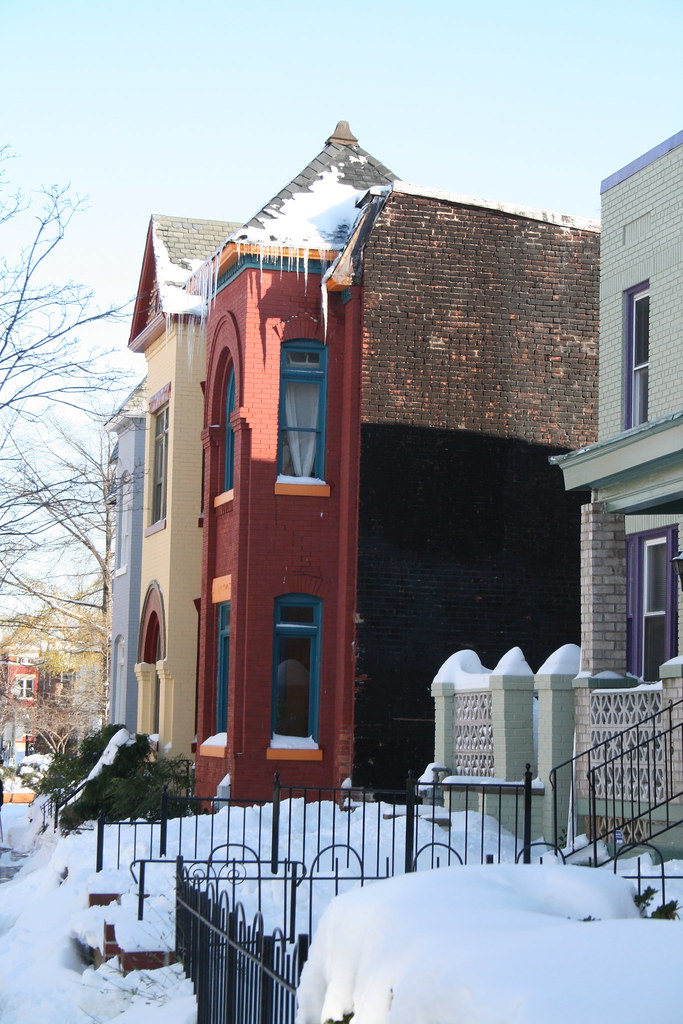
Icicles to kill!
View all our LeDroit Park photos— spring, summer, and fall, too!


Recent Comments