
LeDroit Park slated to get a Capital Bikeshare station this fall
LeDroit Park Civic Association President and ANC 1B01 candidate Marc Morgan has confirmed that our neighborhood is on the short list to receive one of the 15 new Capital Bikeshare stations this fall. The station will likely go at the Park at LeDroit on the Elm Street side.
The District and Arlington continue to buy stations and expand the system, filling in more gaps throughout the densest parts of both jurisdictions. Sure, we don’t quite match the richly bespeckled station density of Montréal or Paris, but local annual budgets include capital line items to purchase more stations.
Despite the fact the system is approaching its second birthday, many news outlets misunderstand the purpose of the system. The annual fee of $75 allows subscribers to rent the bikes at no additional charge for an unlimited number of 30-minute trips.
The 30-minute free period— there’s a charge for longer trips— is supposed to discourage riders from taking out the bikes for hours on end. In fact, the intended purpose is not joy-riding around town, but to facilitate trips that are slightly too long to walk and slightly too short for driving or transit.
For instance, I find CaBi to be to most convenient way to get between LeDroit Park and Dupont Circle. No need to wait for buses or trains, no need to transfer at Gallery Place, no need to hunt for parking.
Stations already exist near LeDroit Park, at 7th and T Streets NW and at First Street and Rhode Island Avenue NW. The new station will finally put LeDroit Park on the CaBi map.
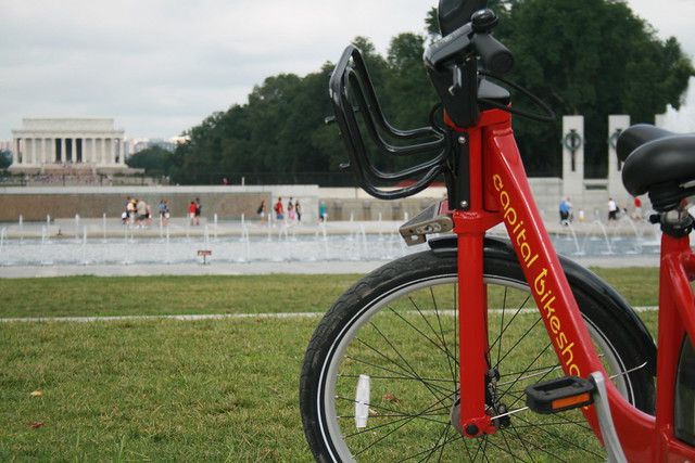
LeDroit Park has plenty of space for Capital Bikeshare

Capita Bikeshare stations near LeDroit Park
An email exchange on the neighborhood listserv discussed lobbying DDOT to install a Capital Bikeshare station in the neighborhood. When DDOT, which oversees the bikesharing system, published its expansion plans for last year, we noted that the system had made it to the neighborhood’s periphery, but not its center.
But where could we fit a CaBi station in LeDroit Park? As one neighbor rightly noted, LeDroit Park’s sidewalks are typically too narrow to accomodate bikeshare stations. Indeed, most of the neighborhood’s sidewalks cannot accommodate bike states while maintaining the minimum 4-foot clearance for wheelchairs. Another neighbor suggested installing a station at the Park at LeDroit, which is District-managed property.
However, the easiest answer is sitting right under our wheels: the street!

The bikeshare station at 17th & T Streets NW in Dupont occupies what used to be the car parking lane.
In several tough places, DDOT has wisely moved the bikeshare stations into the parking lane. In the 600 square feet of public space it takes residents to park three cars, residents can dock 22 bikes. If managing scare public space means optimizing its use for the greatest number of residents, a bikeshare station is a clear winner in efficiency.
Street closures for Chuck Brown’s viewing

Chuck Brown, the Godfather of Go-go, died on May 16. That night a crowd of fans celebrated his life and mourned his death in front of the Howard Theatre.
Brown’s viewing will be held at the Howard Theatre on Tuesday, May 29, from 11 am to 10 pm. To accomodate the expected crown of mourners, DDOT will close several streets to private automobiles on Tuesday. T Street from 7th Street to Florida Avenue will close from 3 am to midnight. The following streets will close from 9:30 am to midnight:
- T Street between 9th Street and Florida Avenue
- 7th Street between Florida Avenue and S Street
- 8th Street between Florida Avenue and S Street
- Wiltberger Street between T Street and S Street
You may still walk or bike along these streets, but if you’re driving, it will be best to avoid the area.
7th & Florida in ’68, ’88, and today

What happened to all the historic buildings at 7th Street, Florida Avenue, and Georgia Avenue? We all recognize the CVS and its adjacent parking lot. As we reported before, the adjacent grassy field is slated for a residential development by JBG, one of the region’s largest development companies.
But how did the CVS, the parking lot, and the grassy field get there in the first place? They are the consequence of the 1968 riots and of the construction of the Green Line tunnels.
The riots of April 1968 destroyed many of the buildings along 7th Street. A few months ago we came across this photo in a Congressional report published in the wake of the riots. The west side of 7th Street from T Street to Florida Avenue was obliterated:

Decades later, the intersection sat at an elbow in the proposed Green Line tunnel. The subway line curves from 7th Street to Florida Avenue and then to U Street. Much of the line was constructed using the cut-and-cover method, which requires razing buildings, digging a trench, building a concrete box in the trench, and covering it back over.
Subway tunnels typically run under existing streets, but sharp changes in direction require cutting corners and thus the creation of tunnels where buildings often stand.
A 1988 photograph shows the construction of the Green Line tunnels, which pass under the CVS and adjacent lots.

What the riots didn’t destroy, the Green Line took care of.
Howard Theatre encourages private parking
To reduce the liklihood that patrons will park on residential streets around the Howard Theatre, the theatre will sell prepaid private parking through Ticketmaster. The passes are for private lots owned by Howard University and other private owners.
In fact, we were looking on Ticketmaster at prices and availability for April’s Wanda Sykes show and spotted this prominent parking add-on at the bottom:

The lots described above are as follows:
- Valet shuttle Lot B – Howard University’s large parking lot at Georgia Avenue and W Street.
- Self-parking Lot A – Howard University’s HURB-I parking lot at 7th & T Streets.
- Premier Valet – private triangle lot at T Street and Florida Avenue, across from the theater.
When Progression Place, the office and apartment project at the Shaw Metro, finally opens, the theatre will lay claim to a significant number of the project’s underground parking spaces during nighttime hours, thus adding a another option.
Metro station names get a little more rational

WMATA decided to revise our iconic Metro map to include the Silver Line and account for slight changes in rush-hour service on the Orange and Blue Lines. The new design, pictured above, ameliorates one of the agency’s usability problems: name sprawl. The new map wisely rearranges several station names to move the less important parts of sprawling names onto smaller subtitles.
When the system was built, station names were originally designed to be short and represent geographic places. Due to politics, local boosterism, and unwise interference from local politicians, some names have exploded in length. The U Street station name, “U Street/African-American Civil War Memorial/Cardozo”, is often cited as the poster child of clunky name sprawl. It wasn’t supposed to be this way. U Street as a place has a history and regional recognition strong enough to stand on its own. The station was originally listed as “U Street”, but then “Cardozo” got tacked on. Worse yet, in 1999 the DC Council voted (and paid) to change the name from “U Street-Cardozo” to the ridiculously longwinded “U Street/African-Amer Civil War Memorial/Cardozo” in honor of the new memorial at the 10th Street entrance.
Since shortening a station name is fraught with political peril— imagine the accusations if you tried to remove “African-American Civil War Memorial” from U Street’s name— WMATA is simply rearranging long names to create primary names and subtitles. U Street isn’t the only station getting this much-needed reordering. Woodley Park (Zoo/Adams Morgan), Gallery Place (Chinatown), Mt. Vernon Square (7th St – Convention Center), and Archives (Navy Memorial – Penn Quarter) are among the other station names that will become less graphically imperious on the map.
T Street renovations reveal old streetcar tracks

Old streetcar rails being removed from the 600 block of T St NW
The Howard Theatre is set to open in April. While construction crews are finishing the theater’s historic restoration, the District government is renovating the entire street in front of the theater. The streetscape project involves replacing the sidewalks, curbs, road pavement, storm drains, and lamp posts on the 600 block of T Street NW and along the one-block Wiltberger Street NW, which abuts the Howard Theatre.
Construction work started at the beginning of February. We were able to get this photo of construction crews removing the old streetcar tracks that were paved over after the streetcar system ceased operation in 1962. In fact the old tracks still lie under many of Washington’s streets; paving them over was cheaper than tearing them up.
Though the streetcars ran along 7th Street/Georgia Avenue and along Florida Avenue, a 1958 streetcar map shows that a short connector linked both of these routes along the 600 block of T Street NW.
DDOT’s plans for the block are ornate and are designed to complement the restored arts venue. The street will feature decorative pavement for both the sidewalk and the roadway. We certainly hope the decorative pavement can withstand the stress of traffic once the street reopens.

Below is the plaza section where T Street intersects Florida Avenue in front of Zenebech. Earlier today we noticed that the sculpture plinth is in place already. The deciduous tree will certainly be a welcome addition to what is now an uninterrupted expanse of concrete.


Weekend Metro closure may bring unintended improvement

Temporarily closing a segment of the Green Line might ironically improve service for some this weekend. WMATA announced that it will close the Shaw, U Street, and Columbia Heights stations this weekend for scheduled track maintenance.
The stations will close at 10 pm Friday and won’t reopen until Tuesday morning’s normal opening time (Monday is a holiday). A similar closure will be in place on the Orange Line between East and West Falls Church stations as Metro works to connect the new Silver Line.
In the meantime, Metro will operate free shuttles along the route to ferry passengers through this service gap. Ironically, these shuttles may sometimes operate more frequently than the rail service would on a typical weekend.
Metro instituted a similar closure along a section of the Red Line on Labor Day weekend. On that weekend, we went to have brunch at a friend’s house in the Brookland neighborhood. During that time, Metro shuttles were running down his street every 2 minutes. Many of the buses were nearly empty, but for a moment we were jealous at the thought of transit service every 2 minutes.
Likewise, if WMATA keeps similarly short headways for the shuttles this weekend, the agency might actually enhance mobility between the Convention Center, Shaw, U Street, Columbia Heights, and Petworth.
One of Metro’s main shortcomings is that riding during non-rush periods, especially on weekends or at night, can entail waiting on platforms for as much as 24 minutes. This is an unacceptably low level of service, but our region lacks the political leadership to set a minimum level of transit service the way we do for utilities.
In DC, where 37% of households lack a car, the mayor and council chairman drive luxury cars at taxpayer expense, and other councilmembers receive free parking in front of the Wilson Building.
In the abstract, our leaders may appreciate the importance of frequent service, but nothing drives home the point like waiting on a Metro platform with 100 other people only to watch a packed train arrive half an hour later.
Though buses can’t match the speed and comfort of rail service, the frequency of bus shuttles this weekend might prove to be a significant, though temporary, transit improvement.
LeDroit Park getting Zipcars soon

Cars on the Corner by M.V. Jantzen, on Flickr
LeDroit Park is getting two Zipcars soon. Though the District auctioned off many of the street spaces reserved for carsharing services like Zipcar, the vast majority of Zipcar’s spaces are actually in private parking lots, driveways, and garages.
Zipcar is always looking for more spaces. If you have a private parking space and would like to rent it to Zipcar, drop them a note online, call their office downtown at (202) 737 4900.
Bikeshare expansion passes over LeDroit Park
Capital Bikeshare, the District’s smashingly successful bikesharing system, will expand this fall. Unfortunately, the expansion plans for this fall exclude LeDroit Park.
The District and Arlington launched the system a year ago with 14 stations in Arlington and 100 in the District. This fall, DDOT will add 34 stations in the District. In our area, DDOT will add a station by the Shaw Library and another at 1st Street NW and Rhode Island Avenue NW in Bloomingdale.
These additions should help alleviate the pressure placed on the existing stations at 7th & T Streets NW in Shaw and at Florida Avenue and R Street NW in Bloomingdale. Currently, LeDroiters and Bloomingdalers compete to use these two stations and thus frequently leave the stations empty or full during rushhour.

Last week DDOT Director Terry Bellamy announced that the district will add 50 stations early next year. We hope that in this new round DDOT focuses more attention on LeDroit Park and other neighborhoods in ANC 1B.
For instance, a Capital Bikeshare station could easily go in at the Park at LeDroit’s south entrance at 3rd and Elm Streets NW. This location is central to the neighborhood and could bring some extra eyes to the park throughout the day.
Outside of LeDroit Park, there is a noticeable station gap in the northern reaches of Bloomingdale and around Cardozo High School.
Capital Bikeshare is particuarly successful in our part of DC for several reasons:
- Car ownership is relatively low compared to the rest of the nation, region, and city. This inclines people to bike more.
- Parking is particularly difficult on many neighborhood streets, thus making cycling more attractive.
- The historical development of this area has permitted the close proximity of commercial uses to residential uses. This means trips to shops and restaurants are short and easily made by bike.
- Downtown is a short ride away and biking is often faster than taking the bus.


Recent Comments