
JBG will extend W Street as a woonerf

JBG revealed more plans for the residential development it plans to build at 945 Florida Avenue NW. This is the site abutting the 965 Florida Avenue, which is slated for a Whole Foods. 945 is slated to be a multifamily building, which is not surprising, but the developer has opted to extend W Street one block from its current terminus at Florida Avenue NW to Ninth Street NW.
The W Street extension has been a long-standing goal of neighborhood planning efforts as there are currently few east-west connections between that section of Florida Avenue and Georgia Avenue. Smaller street grids make walking easier as there are fewer “superblocks” to walk around.
The new one-block extension will be privately built, owned, and maintained. It will be constructed as a woonerf, a street where automobile and pedestrian traffic share the same space. The best example of a woonerf in the area is Cady’s Alley in Georgetown.
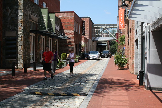
The developer is building the project matter-of-right.
Shaw Giant reopens Nov. 22
In 16 days the Giant at 7th & O Streets in Shaw will reopen after closing for redevelopment in 2011. The new store occupies 78,000 square feet, making it the largest grocery store in the District, and the closest grocery store to LeDroit Park.
Unlike the previous Giant, which was situated with its back to 9th Street, the new Giant will occupy the former historic market building along 7th Street. LeDroit residents can easily access the Giant by foot, bike, or the G2 bus, which runs along the north side of the store along P Street on its way between Georgetown and LeDroit Park.
The store is part of a larger development, City Market at O, which includes 182 hotel rooms, 407 market-rate apartments, and 90 affordable apartments for seniors.
Giant isn’t the only store opening soon. The new Trader Joe’s at 14th & U Streets is set to open early next year.
| Store | Location | Distance (mi) |
|---|---|---|
| Giant (opens Nov. 22, 2013) | 7th & O Streets NW | 0.6 |
| Trader Joe’s (opens early 2014) | 14th & U Streets NW | 0.9 |
| Safeway | 5th & L Streets NW | 0.9 |
| Harris Teeter | 1st & M Streets NE | 1.0 |
| Whole Foods | 1400 blk. P Street NW | 1.1 |
Three new restaurants and one beer garden open in Shaw
The opening of new restaurants on 14th Street has been prolific enough to merit attention from the New York Times and Wall Street Journal. These papers might want to turn their attention to Shaw, which is seeing three new restaurants and one beer garden open within a two-week period. All of these new places are within a mile of LeDroit Park.
Dacha
In time for Oktoberfest, Dacha beer garden opened Wednesday at 1600 7th Street to serve a variety of American, German, and Belgian beers. Dacha, like the Garden District beer garden (née Standard) on 14th Street, will close for the winter. After Dacha closes for the season, the owners will start construction on a permanent building to house the kitchen and bar.
Dacha is open weekdays from 4 pm to 10:30 pm and on weekends from noon to midnight.
Tomorrow from 2 pm to 3 pm, Mayor Gray is cutting the ribbon for three other restaurants, Mandalay, Thally, and Baby Wale.
Mandalay
After you finish your beer at Dacha, walk two blocks to Mandalay at 1501 9th Street, a site that has been in the works for several years. Though the building has been finished for some time, the restaurant, which sits on the ground floor, will open Sunday night for dinner.
Mandalay serves Burmese food, including many vegetarian options. The restaurant will serve eight family-style dishes at seatings at 5:30 pm and 7:30 pm Tuesdays through Sundays. Bring your wallet, though, as the prix-fixe menu is $40 on weekdays and $50 on weekends.
Thally
If you’re not in the mood for Burmese food, walk two blocks south on 9th Street to Thally (1316 9th Street), which opened last week. The restaurant, pronounced like ‘tally’, serves “modern American” food. First course items range from $8 to $10 and include peach and prosciutto soup, fancy BLTs, and crab roulette. Main course items range from $17 to $28 and include roasted duck, delmonico steak, and rockfish.
Thally is open from 5 pm to 11:30 pm Tuesdays through Sundays.
Baby Wale (I hope that’s not a menu item!)
If you’re more in the mood for wine and snacks, continue walking two blocks south to Baby Wale (1124 9th Street), a project of the Tom Power, who started Corduroy next door. Baby Wale, which opened last week, is far more casual than its upscale neighbor and serves soups, salads, sandwiches and “upscale bar food”. As for alcohol, the place serves specialty cocktails, 80 different bottles of wine, and six draft beers.
Baby Wale opens at 5 pm Mondays through Saturdays.
It’s amazing how quickly new restaurants are opening on Shaw’s primary main streets. Even more food options are on the way as Progression Place’s storefronts continue to fill and as the new Giant opens in November at 7th and O Streets.
| Name | Address | Distance | Cuisine |
|---|---|---|---|
| Dacha | 1600 7th St | 0.6 mi | beer garden |
| Mandalay | 1501 9th St | 0.7 mi | Burmese |
| Thally | 1316 9th St | 0.8 mi | Modern American |
| Baby Wale | 1124 9th St | 1.0 mi | wine and bar food |
August 8 – LeDroit Park Happy Hour

Photo by M.V. Jantzen on Flickr
It’s that time again! Come for drinks, free appetizers, and chat with your neighbors Monday, August 6 from 6 to 8 at Nellie’s (9th & U Streets NW). Nellie’s owner, a LeDroit Park resident, has kindly donated appetizers for the event.
Your favorite neighborhood blogger will be there, too!
Time lapse video of CityMarket at O
You already know about Trader Joe’s plans for 14th & U Streets next year. In Shaw the CityMarket at O project will bring a 60,000-square foot Giant that will be LeDroit Park’s closest full-service grocery store.
The project covers two city blocks bounded by 7th, O, 9th and P Streets. Construction is well underway and the construction company has installed a cellphone camera across the street to track the construction progress. Here’s a time lapse video of the project so far:
How LeDroit Park Came to be Added to the City
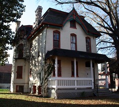
The following is a Washington Times article from 1903. The article explains some of the early history of the neighborhood and even includes three photos, the first of which was misidentified as Fifth Street, though we have actually matched it up with Second Street. We have included a few links to related information.

Second Street opposite the Anna J. Cooper House.
HOW LE DROIT PARK CAME TO BE ADDED TO THE CITY
Washington Times
Sunday, May 31, 1903For Many Years the Section of Washington Known by That Name Had Practically Its Separate Government and Had All the Characteristics of a Country Town, Although Plainly Within the Boundary Limits. * * *
In that portion of Florida Avenue between Seventh Street and Eighth Streets northwest where the street cars of the Seventh Street line and the Ninth Street line pass over the same tracks, thousands of passengers are carried every day, and probably but a few if any realize the fact that they are passing over a road older than the organization of the city, a road that dates back to the Revolutionary period— the Bladensburg Road, which connected Georgetown with Bladensburg before the location of the National Capital was determined.
The Map on the Wall.
If the people passing this point will note the little frame building occupied by a florist, 713 Florida Avenue northwest, they will observe that in front of these premises and fastened to the blacksmith shop adjoining is a goodly sized signboard on which is painted an old map of this section and showing the intersection of the old Blandensburg Road and Boundary Street, now known as Florida Avenue. From this map it is seen that Seventh Street Road [now Georgia Avenue] intersects Boundary Street and the old Bladensburg Road at a point about 100 feet east of where the two roads join at an acute angle, and glancing along the lines of Boundary Street and the north lines of some buildings which have been erected in this angle we easily see the direction of the Bladensburg Road and discover that the small building 713 Florida Avenue northwest marks the spot where the Bladensburg Road deflected from Boundary Street and bore off in a northeasterly direction toward Bladensburg.
Once Part of Jamaica Vacancy.
The map referred to is said to be a portion of [the estate named] Jamaica and and Smith’s Vacancy, but if we examine the plats in the office of the Surveyor of the District we will hardly find on file any plats of those sections, but may learn that Le Droit Park was once part of Jamaica and Smith’s Vacancy and possibly a portion of [the estate named] Port Royal. Prior to the cession of the territory now included in the District from Maryland the land known as Jamaica was owned by one Philip R. Fendall, of Virginia. He conveyed this tract of 494 acres on the 12th day of January, 1792, to Samuel Blodgett, jr., of Massachusetts, and from this point the title of the land can be traced down to the present time.
The names attached to the different vacancies establish the names of the various owners of lands adjoining Bladensburg Road at the time it was abandoned as a thoroughfare and taken up as a portion of the farms in that section, and the presence of this old road accounts for some of the peculiar lines in some of the northern boundaries of some of the lots in Le Droit Park. This road crossed Second Street at a point north of Elm Street here. The old plats show Moore’s Vacancy. The road finally joined the present road to Bladensburg at a point where the sixth milestone of the norther line of the District was located.
It is probable that this peculiarly natural boundary of some of the lands which afterward became Le Droit Park may have had something to do with the strange lines which are found in the streets of that suburb, although it was not the intention at the time that Le Droit Park was subdivided to have the streets conform with the city streets.
Site of Campbell Hospital.
During the civil war the territory now contained in Le Droit Park was used as the site of Campbell General Hospital, one of the important hospitals near Washington. The hospital comprised some seventeen separate wooden buildings, erected in the form of a hollow square, with the central portion divided into irregular spaces by buildings cutting across the inclosure and connecting the outside buildings.
The larger dimension of this hospital was fro north to south, and extended from Boundary Street, now known as Florida Avenue, on the south, to the land occupied for many years as a baseball park, situated south of Freedman’s Hospital, and designated on some of the old maps as Levi Park. From east to west the hospital covered the ground from Seventh Street to what is now known as Fifth Street in Le Droit Park, and it is possible that a portion of the space between Fifth Street and Fourth Street was also included in the hospital inclosure.

The McClelland Residence.
At this time there were only two dwellings in the tract known afterward as Le Droit Park— the McClelland and Gilman homestands. Each included about ten acres of land used for grazing and garden purposes. The McClelland property and the Gilman property were divided by a row of large oak trees which were situated about fifty feet apart and continued from Florida Avenue, then Boundary Street, to the northern line of the park.
[See the following 1861 map, a map we extolled several months ago:

]
To the east of the Gilman tract was a narrow strip of land known as the Prather tract. East of this was Moore’s Lane, now Second Street, and still to the east was the tracts of the Moores, George and David, covering the territory as far east as the present location of Lincoln Avenue [now Lincoln Road], on which was located Harewood Hospital, another hospital of considerable note during the civil war.
T.R. Senior, who was commissary at Campbell Hospital, returned to the city some twelve years after the war closed and purchased a residence at the corner of Elm and Second Streets, where he now resides. Members of the family of David McClelland now occupy the old homestead on Second Street.
Following the close of the war it became necessary to provide for such of the freedmen as were in need of assistance. Campbell General Hospital was occupied by the freedmen until August 16, 1869, when the patients were transferred to the new Freedman’s Hospital, which has been erected in connection with Howard University.
The property upon which Freedman’s Hospital stands consisted of a tract of 150 acres and was purchased from John A. Smith. In April, 1867, Howardtown was laid out and soon after some 500 lots were sold, and at this time it seems that the idea was conveyed that streets would be opened to the south through the Miller tract. In April, 1870, the Howard University purchased the Miller tract, and laid out streets to connect the streets of Howardtown with the city streets, and a little later built four houses on the line of what is now known as Fourth Street and in 1872 subdivided the Miller tract, but for some reason the plat was not recorded.
In 1873 the Miller tract was sold by Howard University to A[ndrew] Langdon, and a short time afterward A[mzi] L[orenzo] Barber, formerly secretary of Howard University, became associated with Langdon and hs partner, and by arrangements with D[avid] McClelland, all of the three tracts known as the Miller tract, the McClelland tract, and the Gilman tract were united and subdivided, and in June, 1873, a subdivision known as Le Droit Park was placed on record in the surveyor’s office. A subsequent plat was filed some eighteen months later, in which the proprietors of the subdivision declared it to be their purpose and intention to retain and control the ownership of all the streets platted, and the right to inclose the whole or any portion of the tracts or tract included in the subdivision and to locate and control all entrances and gates to the same.

During the autumn of 1876 A. L. Barber & Co. commenced the erection of fences across the north line of Le Droit Park, and from this time until August, 1891, fences were maintained along the northern line of the park. From 1886 to 1891 frequent fence wars were in operation. The fence across what is now Fourth Street would be removed by one party, and the opposing party would secure an injunction and restore it. This mode of procedure was repeated at various times until in 1901 a compromise verdict was agreed upon by the two factions and the fence was removed, Fourth Street was improved north of the park, and the streets of the park passed into the control of the city after a period of some eighteen years of private ownership.
The organization of Le Droit Park, under the limitations of the plat filed in 1873, was a peculiar experiment, that of the founding of an independent suburb adjoining the city. the southern line of the park was inclosed with a handsome combination iron and wood fence, some of which may now be found on the southern line of the McClelland property. Buildings were erected with plenty of room around them, and during the period from 1873 to 1885 the larger part of the buildings were planned and erected by James H. McGill. Double houses were quite common, but it was not until 1888 that such a thing as a row of houses were known in the park.
Before control of the streets was surrendered to the city the conditions existing in the park resembled closely those found in small country towns. Many of the inhabitants owned cows, which were pastured upon the vacant lots; the women “went a-neighboring,” and the social life savored strongly of a village, and yet it was near the city. The express and telegraph messengers, however, always collected of residents an extra fee for the reason that they lived out of the city.
With the opening of the streets and the introduction of street cars the park soon lost its former characteristics and became part of the city with all of its advantages and disadvantages. The opening of Rhode Island Avenue [from Florida Avenue eastward] spoiled in a measure the former beauty of the McClelland and Gilman homesteads, although there is still much more ground remaining in both of these old tracts that many people would care to own. The opening of Fifth Street will, to some extent, divide the traffic which now finds a way through Fourth Street. Sixth Street ends at Spruce Street [now U Street], and further progress seems barred by the residence, 601 Spruce Street, and there seems no immediate chance of the extension of Third Street above its present limit [at V Street??], where progress is barred by a high fence decorated with the advertisement of a prominent firm.
Former Familiar Street Names.
The old names of the streets of the park, such as Harewood Avenue [now Third Street], Maple Avenue [now U Street], Moore’s Lane [later Le Droit Avenue, then Second Street], Linden Street [now Fourth Street], Larch Street [now Fifth Street], Juniper Street [now Sixth Street], and Bohrer Street [still extant], are nearly forgotten, and have passed away with the fence and its period. The names of the city streets have taken their places, and with the growth of the population the country life and country scenes have given way to those of the city.
U Street Booze Moratorium

At last night’s monthly meeting of ANC1B, Councilmember Jim Graham (D – Ward 1) suggested that the neighborhood could “benefit from discussion” of a liquor license moratorium on U Street. While the U Street corridor has experienced significant growth in the number of restaurants and bars over the past ten years, not everyone is happy with the revival. The bar scene, in the midst of a dense neighborhood is bound to create conflict especially as the corridor becomes a regional destination for bar-goers.
In fact one of the attractive features of U Street is that its bars have not become as raucous and overcrowded as those in Adams-Morgan. Part of the reason is that U Street attracts a different crowd (read: fewer college students) and includes more restaurants than actual bars. Furthermore, U Street stretches 0.8 miles (from Ninth to Seventeenth Streets) compared to Adams-Morgan’s 0.4 mi (along Eighteenth Street from U Street to Columbia Road). In reality the main bar strip of Adams-Morgan is packed into the 0.2 miles between Kalorama and Columbia Roads. That’s only one-fourth the length of the U Street corridor.

We know Adams-Morgan and U Street is no Adams-Morgan.
A moratorium on U Street would freeze the supply of available bar and restaurant space without alleviating the demand. In other words, a moratorium would eventually pack the existing venues. Customers will be stuck with the same selection of venues and would suffer higher prices and larger crowds at each venue.
Furthermore, we argue that this issue is already being addressed through two other avenues. First, the ANC is careful to review liquor licenses and doesn’t hesitate to strongarm restaurateurs and barkeeps into so-called “voluntary agreements” that stipulate a variety of restrictions. These restrictions aim to maintain the livability triumvirate of “peace, order, and quiet” so that neighbors can sleep without a cacophony of throbbing music, boisterous drunks, and gun shots. The process is not perfect, but neighbors are legally entitled to input and negotiation.
Second, the liquor issue is already being addressed by proxy of the zoning code. As we reported before, no more than 25% (soon to be raised to 50%) of street frontage along Fourteenth Street and U Street within the Uptown Arts Overlay zone can be devoted to food establishments. Since restaurants make much of their money by serving alcohol, the raising of the cap to 50%, an increase with significant, though not universal, community support, implies the acceptability of a commensurate increase in liquor licenses.
* * *
In other news, the ANC voted unanimously to approve the renewal of Class C restaurant liquor licenses for the following businesses:
- Shashemene Ethiopian Restaurant – 1909 Ninth Street NW
- Ambassador Restaurant – 1907 Ninth Street NW
- Zula Restaurant – 1933 Ninth Street NW
- Sala Thai – 1301 U Street NW
- Vinoteca – 1940 Eleventh Street NW
- Red Lounge – 2013 Fourteenth Street NW
- Gori Café – 1119 V Street NW
- La Carbonara – 1926 Ninth Street NW
- El Sol de America – 1930 Ninth Street NW
- Salina Restaurant – 1936 Ninth Street NW
- Chix – 2019 Eleventh Street NW
- Masa14 – 1825 Fourteenth Street NW (rooftop license modifications are a separate matter)
- Source – 1835 Fourteenth Street NW
- Prince Hall Freemason & Eastern Star Charitable Foundation – 1000 U Street NW
- Islander Caribbean Restaurant & Lounge – 1201 U Street NW
- The Saloon – 1205-1207 U Street NW
- Ulah Bistro – 1214 U Street NW
- Lincoln Theater – 1215 U Street NW
- Café Nema-Momo’s – 1334 U Street NW
- Dynasty Ethiopian Restaurant – 2210 Fourteenth Street NW
The ANC voted to withdraw its protest and enter into a voluntary agreement with Mesobe Restaurant (1853 Seventh Street NW). The commissioners voted to protest the renewal of Expo Restaurant and Nightclub (1928 Ninth Street NW) on account of noise and trash. They aim to draft a voluntary agreement with Expo. The commission decided to take no action on the renewal of licenses for Yegna (1920 Ninth Street NW) and Eatonville (2121 Fourteenth Street NW).
Coffeehouse Coming to Florida Avenue
At tomorrow’s monthly meeting of ANC1B, representatives for a fledgling coffeehouse/lounge, The Independent (715 Florida Avenue NW), will petition for a Class C liquor license. The Independent seeks to serve beer, wine, and liquor to a maximum of 235 people (199 seats) on the first floor and a maximum of 90 people (75 seats) in the summer garden. They propose these hours:
| Sun | Mon | Tue | Wed | Thu | Fri | Sat | |
|---|---|---|---|---|---|---|---|
| Open | 7am | ||||||
| alc. served | 10am | 8am | |||||
| last call & close | 2am | 3am | |||||
Entertainment will run 6pm – 2am (Sun. – Thurs.) and 6pm – 3 am (Fri. and Sat.).
Up at 2632 Georgia Avenue, GII Restaurant & Lounge plans to host acoustic jazz bands, karaoke, open mike nights, and DJs to a maximum of 102 people (86 seats). They propose the following business hours: 6 am-2:30 am (Mon. – Wed.) and 6 am-3 am (Thurs. – Sun.). The propose serving alcohol 10 am-2 am (Sun.), 8 am-2 am (Mon. – Thurs.) and 8 am-3 am (Fri. and Sat.). Entertainment will be 6 pm-2:30 am (Mon. – Wed.) and 6 pm – 3 am (Thur. – Sun.).
Here in LeDroit Park, the Elks Lodge at 1844 Third St seeks to renew its license but not without controversy. In April 2008 the lodge was the site of a triple-stabbing and just a few months ago, the lodge was delinquent in paying license fines.
In addition to the lodge, the following restaurants seek to renew their licenses:
- Alero Lounge, 1301 U Street, Class C
- Crème Café & Lounge, 1322 U Street, Class C
- Little Ethiopia Restaurant, 1924 Ninth Street, Class C
- Portico, 1914 Ninth Street, Class C
- Mesobe Restaurant and Delimarket, 1853 Seventh Street, Class C
As usual, the ANC meeting will be held tomorrow (Thursday) at 7 pm on the second floor of the Reeves Building at Fourteenth and U Streets.
Are There Too Many Restaurants?
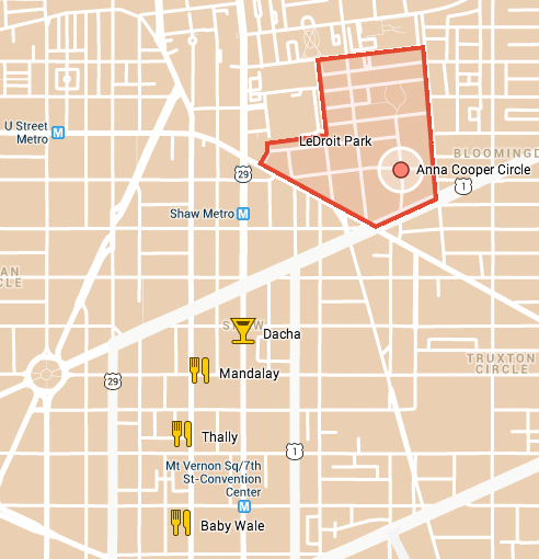
Are there too many restaurants, bars, and cafés on U Street and Fourteenth Street? According to the zoning code, the answer is yes.
View U-14th-Florida-9th Arts Overlay in a larger map
The Uptown Arts Overlay District (shaded in red above) covers much of the commercial areas on U Street and Fourteenth Street (and some side streets) and limits eating establishments in the zone to 25% of the linear frontage as measured along Fourteenth and U Streets in the zone (red lines above). The original purpose of the limitation was to prevent the area from becoming “overrun” with restaurants, thus crowding out other non-eating establishments.
DCRA recently finished surveying the zone and found that the area is a mere 12.6 feet short of hitting the 25% limit, meaning that DCRA will not issue new Certificates of Occupancy or Building Permits for restaurants unless they receive zoning variances. Variances takes months to approve and aren’t guaranteed. Now opening even a modest café will require much more time and money and may require hiring a lawyer to apply for zoning variances.
The MidCity Business Association is upset and is demanding a zoning text amendment to raise the limit from 25% to 50%. Their fury directed at DCRA is unwarranted, though, as the agency must enforce zoning laws.
MidCity, though, has a lot of support on its side. Last year the three ANCs in the overlay, 2B, 2F, and 1B, as well as the Logan Circle Community Association and the U Street Neighborhood Association all supported increasing the limit from 25% to 50%. Though the changes to the Uptown Arts Overlay were expected to be included as part of the District’s city-wide zoning rewrite, DCRA’s recent decision, combined with the fact that the city-wide zoning rewrite is over a year away, have given new urgency to an immediate text amendment.
Now it is the time to act. As Greater Greater Washington (GGW) explains, zoning amendments typically originate from either the Zoning Commission or the Office of Planning, but an ANC or ordinary citizen can propose a text amendment, too. The Zoning Commission, if it decides to take up the matter, would hold a hearing and decided whether to approve the amendment.
Limiting the space devoted to eating establishments allows for more space devoted to neighborhood-serving retail such as dry cleaners, grocery stores, furniture stores, and clothing stores. Even still, restaurants serve residents, too, and the 25% limit is too low. Seventeenth Street in Dupont, as GGW explains, enjoys a sufficient variety of neighborhood-serving retail stores even though frontage devoted to eating establishments far exceeds 25%.
The Overlay extends as far east as the Howard Theater and even down Ninth Street’s Little Ethiopia. If the 25% rule holds, don’t expect any new restaurants to open up there, either. [see update below]
What do you think? Should the District allow more eating establishments in the area?
Update: We emailed the Office of the Zoning Administrator for clarification, and we stand corrected: “The 25% restriction only applies to businesses within the subset of 900-1400 blocks of U St NW and the 1300-2200 blocks of 14th St NW; so a potential restaurant on 9th St NW would be able to proceed without seeking BZA relief.”
Activity at 1922 Third Street
 The house at 1922 Third Street (Third and U Streets) is one of the LeDroit Park’s gems and is about to receive some much needed attention. At Thursday’s ANC1B meeting, Community Three Development will submit this concept to renovate the main house, to renovate the carriage house, and to build a new townhouse at the southern edge of the property.
The developer recently finished the swanky M Street Flats located in Mount Vernon Triangle area. The group also completed The Nine on the 1300 block of Ninth Street, backing up to the historic Naylor Court. If these forerunners are any indication, 1922 Third Street may receive a high-end renovation.
The developer’s design, in his words,
creates an addition to the existing main building that is smaller in scale and secondary to the main building, allowing the main structure to continue to read as the dominant form on the site. This addition terminates in a “carriage house court,” designed to celebrate the existing carriage house, while maintaining the historic structure’s existing view corridor from U Street. A new unsubdivided townhouse lot and structure is created to terminate the row of townhouses directly to the south of the site. The result of these interventions preserves and enhances the character and urban form associated with the main structure and corresponding carriage house.
Though Community Three will need the approval of the city’s Historic Preservation Review Board for the overall project, they are not seek zoning variances.
The proposal calls for 14,000 gross square feet of space and features 14 residential units and four garage spaces— a mixture that the developer claims zoning ordinances permit.
Here are some drawings and diagrams from the concept. Note that the developer proposes to add a new rowhouse on the south side of the property (middle-left of the first drawing)

1922 Third Street concept, east face on Third Street
In the next drawing, the concept preserves the historic carriage house (on the right) and connects it with the main house with a new structure (middle) with a hipped roof that mimics the former and dormers that mimic the latter.

1922 Third Street concept, north face on U Street
With the new connecting building and rowhouse the project will increase the building footprint on the lot.

1922 Third Street concept, footprint
What do you think of the concept? Leave your questions and comments below and we will try to ask the developer any unanswered questions at Thursday’s ANC1B meeting.


Recent Comments