
Urgent: The Thomas U-Turn
After last year’s contracting controversy simmered down, Councilmember Harry Thomas, Jr. (D – Ward 5), assured residents that he would not block the park project in LeDroit Park. He wrote in an email:
I would like to confirm that I am in support of moving forward with this project and supportive of the steps and work that the LeDroit Park community and many members from the Bloomingdale neighborhood have taken to support the Ledroit Park Project and will commit to ensuring that I will continue to support a contract process that moves this project forward and ensures its completion. (our emphasis)
It seems a councilmember is entitled to change his mind.
Mr. Thomas will introduce a bill tomorrow in the Committee on Libraries, Parks & Recreation, a committee he chairs, to prevent the mayor’s office from allotting $1.5 million for the park.
We’re not sure why Mr. Thomas has changed his mind, but residents are encouraged to call him or email him to ask why and to express the importance of the park. If the site remains a mud pit in November, voters in Bloomingdale (Ward 5) may remember that on their way to the polls.
| Harry Thomas, Jr. (D – Ward 5) Committee chair |
hthomas@dccouncil.us | (202) 724-8028 |
| David A. Catania (I – at large) | dcatania@dccouncil.us | (202) 724-7772 |
| Kwame R. Brown (D – at large) | kbrown@dccouncil.us | (202) 724-8174 |
| Phil Mendelson (D – at large) | pmendelson@dccouncil.us | (202) 724-8064 |
| Yvette Alexander (D – Ward 7) | yalexander@dccouncil.us | (202) 724-8068 |
Activity at 1922 Third Street
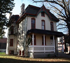 The house at 1922 Third Street (Third and U Streets) is one of the LeDroit Park’s gems and is about to receive some much needed attention. At Thursday’s ANC1B meeting, Community Three Development will submit this concept to renovate the main house, to renovate the carriage house, and to build a new townhouse at the southern edge of the property.
The developer recently finished the swanky M Street Flats located in Mount Vernon Triangle area. The group also completed The Nine on the 1300 block of Ninth Street, backing up to the historic Naylor Court. If these forerunners are any indication, 1922 Third Street may receive a high-end renovation.
The developer’s design, in his words,
creates an addition to the existing main building that is smaller in scale and secondary to the main building, allowing the main structure to continue to read as the dominant form on the site. This addition terminates in a “carriage house court,” designed to celebrate the existing carriage house, while maintaining the historic structure’s existing view corridor from U Street. A new unsubdivided townhouse lot and structure is created to terminate the row of townhouses directly to the south of the site. The result of these interventions preserves and enhances the character and urban form associated with the main structure and corresponding carriage house.
Though Community Three will need the approval of the city’s Historic Preservation Review Board for the overall project, they are not seek zoning variances.
The proposal calls for 14,000 gross square feet of space and features 14 residential units and four garage spaces— a mixture that the developer claims zoning ordinances permit.
Here are some drawings and diagrams from the concept. Note that the developer proposes to add a new rowhouse on the south side of the property (middle-left of the first drawing)

1922 Third Street concept, east face on Third Street
In the next drawing, the concept preserves the historic carriage house (on the right) and connects it with the main house with a new structure (middle) with a hipped roof that mimics the former and dormers that mimic the latter.

1922 Third Street concept, north face on U Street
With the new connecting building and rowhouse the project will increase the building footprint on the lot.

1922 Third Street concept, footprint
What do you think of the concept? Leave your questions and comments below and we will try to ask the developer any unanswered questions at Thursday’s ANC1B meeting.
Radio One Pulls Out; Shaw Metro Still Barren

Broadcast Center One as viewed from the CVS at 7th & T Streets
We reported a few days ago that the developer for Media Center One (a.k.a. Broadcast Center One), a mixed-use project slated for the area around the Shaw Metro, had inked a lease with the United Negro College Fund (UNCF). Good news for the long-delayed project.
Now the Washington Business Journal reports that the main tenant, Radio One, has inexplicably decided to stay put in the glitzy media town of Lanham, Maryland.
Though the development team says the project will go forward, we have trouble believing they can secure additional financing until they sign a replacement tenant.
At the previous ANC1B meeting, a lawyer representing the development group announced the group’s intention to convert 50,000 square feet of apartment space into office space. With Radio One out of the picture, perhaps they can revert the 50,000 square feet to apartments.
What’s most upsetting is that in January 2008, the District offered $23 million in subsidies to lure Radio One to the city. Two years and two months later, the land still sits vacant while Radio One just wasted two years of the taxpayers’ time.
We hope the developer finds a replacement soon, but unless the city is able to transfer the subsidy to another commercial enterprise, any struggling firm may balk at the District’s ridiculously high 9.975% corporate income tax rate— especially when Maryland and Virginia only charge 8.25% and 6.0%, respectively.
Old Maps: The District Before LeDroit Park (1792 – 1859)
This is the first in a series of posts about historic maps of LeDroit Park.
When the Federal Government established the national capital, it was to be located within a 100-square-mile diamond straddling both sides of the Potomac. In fact, the City of Washington was just one of several established cities and settlements in the nascent Federal District, later called the District of Columbia. The City of Washington, as defined by Congress and Peter L’Enfant’s plan, was bounded by the Potomac River and Rock Creek to the west, the Anacostia River to the south and east, and by Boundary Street (now Florida Avenue) to the north. LeDroit Park sits just north of Florida Avenue, in what was originally the rural Washington County, District of Columbia. The District also included the City of Georgetown, the City of Alexandria, and Alexandria County (now Arlington County, Virginia).
The map below, dating from 1792, was the first printed version of the L’Enfant Plan (as amended by Andrew Ellicott) for the City of Washington. Notice that its northern boundary coincides with what is now Florida Avenue. LeDroit Park now sits just to the west of what is marked as “Tiber Creek”. The creek, also called Goose Creek before the founding of the city, originally ran between First and Second Streets NW through Bloomingdale all the way to what is now Constitution Avenue NW, and westward toward the Washington Monument grounds, where it emptied into the Potomac River. Much of the creek is now buried in pipes beneath the city.
 Download the full version of this map from the Library of Congress
(We have a reliable method of identifying the future LeDroit Park on old maps of Washington: look for New Jersey Avenue NW, which runs diagonally to the northwest from the Capitol. Directly north of where it ends at the city’s border is where LeDroit Park would later be built.)
The capital city grew slowly over the coming decades with new residents, including government workers and Members of Congress, housed in newly constructed houses and boarding houses near the White House and Capitol, respectively. The difficulty in finding enough skilled labor to build a capital city required the leasing of slaves, who were instrumental in constructing many of the grand public buildings that stand today.
It would be a mistake to look at the map above and assume that all the new streets and canals were built together. In fact, the L’Enfant Plan was just that, a plan. The grand, spacious avenues required the clearing of trees and brush after a tedious survey to match the ground with the map.
In fact, by 1842 so much of the city was incomplete that a visiting Charles Dickens belittled Washington as a “city of magnificent intentions” marked by
spacious avenues, that begin in nothing and lead nowhere; streets, mile-long, that only want houses, roads, and inhabitants; public buildings that need but a public to be complete; and ornaments of great thoroughfares, which only lack great thoroughfares to ornament.
Whereas the global financial markets of today allow developers to develop large tracts of land at once, 19th-century cities had to be built piecemeal with speculation limited to small projects. LeDroit Park was no different: only several houses and only a few streets were built at first with the rest to come later.
From 1856 to 1859, German cartographer Albert Boschke charted the District hoping to sell his maps to the U.S. Government. His 1859 map of the City of Washington (below) provided illustrative evidence supporting Charles Dickens’s sneer. Much of Washington, especially its northern reaches near what was to become LeDroit Park, sat undeveloped with only a few cleared streets.
") Download the full version of this map from the Library of Congress. To aid orientation, we have superimposed a few street names.
Download the full version of this map from the Library of Congress. To aid orientation, we have superimposed a few street names.
The only clear north-south street was Seventh Street, which connected the city with the rural county and stretched into Maryland (albeit under different names). At R Street— if one could call it a street— it crossed an open creek that ran through the right-of-way.
Seventh Street’s primacy as the main north-south thoroughfare actually contradicts the intention of the L’Enfant Plan, whose Baroque determination to provide a “reciprocity of sight“, plotted Eighth Street, not Seventh Street, as the more important axis. In fact to this day the right-of-way of Eighth Street is fifteen feet wider than those of Seventh and Ninth Streets, even though Eight carries only a fraction of the traffic burden that the parallel streets carry.
It is difficult to enforce one artistic vision on a democracy; the shifting of axes, from Eighth to Seventh, merely reflects the fact that cities are shaped by their inhabitants in ways the founders never anticipate. The future LeDroit Park was no different.
Next: Alfred Boschke maps the entire District and a future LeDroit Park resident prints it, only to have it seized at gunpoint.
The Restoration

Good news on the park front. Mr. Jose Sousa from the Office of the Deputy Mayor for Planning and Economic Development (DMPED) announced at the civic association meeting last night that Councilmember Jim Graham (D – Ward 1) insisted that DMPED restore the $200,000 in cuts to the park construction budget for LeDroit Park.
As we reported last month, the deputy mayor’s office had reduced the budget for the park from $1.7 million to $1.5 million as the result of citywide belt-tightening. The remaining $200,000 will be restored legislatively to be paid in the coming fiscal year, which begins on October 1, 2010. Though the park is still set to open in September, Mr. Sousa said that the remaining $200,000 could be spent right away in October to close up loose ends on the project.
In a month or so the design team will host a meeting to discuss additional design details for the park. We’ll keep you informed.
ANC1B Update: Media Center One Inches Forward, Masa Hits the Roof
Broadcast Center One as viewed from the CVS at 7th & T Streets
Snowpocalypse 2: Electric Boogaloo and other matters kept us too busy to follow up on the February meeting of ANC1B, so here is the belated report of the highlights.
The owner of 1916 Ninth Street requested a variance to allow him to use the house as an art gallery. His description of the renovation included achieving LEED Platinum certification for the old rowhouse.
The owner of 321 T Street sought and received ANC support for his conceptual design of his proposed renovations to the rowhouse on T Street here in LeDroit Park. The owner had presented the plan at the previous LeDroit Park Civic Association meeting and didn’t receive any opposition.
Finally, a lawyer representing Media Center One (a.k.a. Broadcast Center One) (pictured above) requested and received approval for a two-year extension for the planned unit development (PUD) application for the project. The developer’s representative blamed the financial markets (of course), sympathized with the community’s “development fatigue” and said that the project was moving forward thanks to the successful leasing of office space to the United Negro College Fund in addition to Radio One.
The reconfigured project will remain largely the same, except 50,000 square feet of apartment space will become office space. That means the project will include 133 apartments instead of 180 and will include 160,000 square feet of offices instead of 110,000 square feet.
Groundbreaking is now set for June or July 2010.
On the liquor front, Ulah Bistro received the ANC’s assent to host DJs and jazz bands Sunday through Thursday nights 9 pm to 1:30 am and Friday and Saturday nights 9 pm to 2:30 am. Ulah is one of the few licensees in the U Street area without a voluntary agreement.
The proprietors for Bella (900 Florida Avenue NW) did not show up and the ANC protested their request for a license.
Finally, the proprietor of Masa 14 (1825 Fourteenth Street) presented the most contentious proposal of the night, requesting that their liquor license extend to their proposed roof deck (see the drawings) permitting them to sell alcohol Sunday through Thursday 8 am to 2 am and Friday and Saturday 8 am to 3 am. Some neighbors voiced concern that the roof deck would create too much noise and doubted that a place described as restaurant would need to serve alcohol so late into the night. The ANC voted to protest the application until the owner and the ANC could come to a voluntary agreement. [Clarification: the ANC typically protests all new liquor licenses as a tactical move to goad applicants to reach what is called a “voluntary agreement” (VA) with the ANC. These voluntary agreements are less permissive than the District’s standing liquor laws.]
The next meeting is set for Thursday, March 4, 2010, at 7 pm on the second floor of the Reeves Building at Fourteenth and U Streets.
Civic Association Meets Tues, Feb 23
The LeDroit Park Civic Association meets tomorrow night, Tuesday, February 23, at 7:00 pm in the basement of the Florida Avenue Baptist Church. (Enter through the back at U and Bohrer Streets)
This month’s agenda:
- Introduction to MPD Third District Commander Jacob Kishter
- Presentation on the Howard University Campus Plan
- Community survey
- Zoning variance request for Howard University Hospital
- Update on the forthcoming park—Jose Sousa, Office of the Deputy Mayor for Planning and Economic Development
- Civic Association Volunteer Opportunities
As always, all are welcome to attend.
Washington in the ’70s
WETA is airing the second in a series of documentaries about the recent history of Washington. It began with Washington in the ’60s, since, as baby-boomers insist, history began in 1960— the rest was a trifling prelude.
Tonight comes Washington in the ’70s, the bellbottom-clad follow-up featuring the construction of the Metro system, Marion Barry getting shot, and a president losing his job over a local burglary.
Catch it on channel 26 (WETA) tonight at 9 pm. (Check rebroadcast times)
The Combined Sewer Paradox
 After big snowstorms, the melting snow swells the Potomac and Anacostia for days. The good news is that in older parts of Washington, including LeDroit Park, the heaps of gray slush— snow mixed with car grease, road salt, and road sand— will not be dumped straight into the rivers as it will be in the rest of the Washington area as the City Paper reports.
In older parts of the city built before 1900 (see the map), our sewers and our storm drains are the same system, meaning that the water leaving your sink joins up with the same water running into the street grates. Only older cities have this combined system; the rest of the the Washington area, including newer parts of the District, have separate pipes for sewage and for storm water.
This combined system is usually considered an environmental problem, since occasional heavy rainfalls inundate the combined system, forcing it to eject both storm water and raw sewage into the rivers and Rock Creek for a few hours through 53 outfall points.
However, with melting snow, the system is reversed into an environmental virtue, since the melting slush—salt, sand, grease, and all— are filtered with household waste at the Blue Plains treatment plant at the southern end of the District.
Let’s call this the combined system paradox: an environmental threat to the city’s waterways in the spring and summer becomes an environmental steward when winter snows melt.
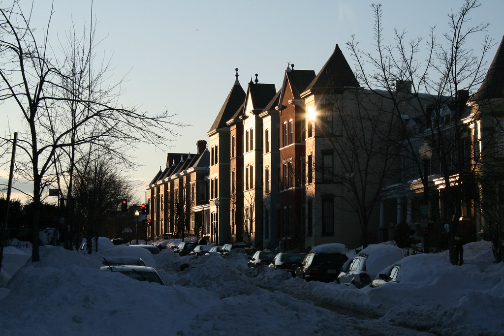
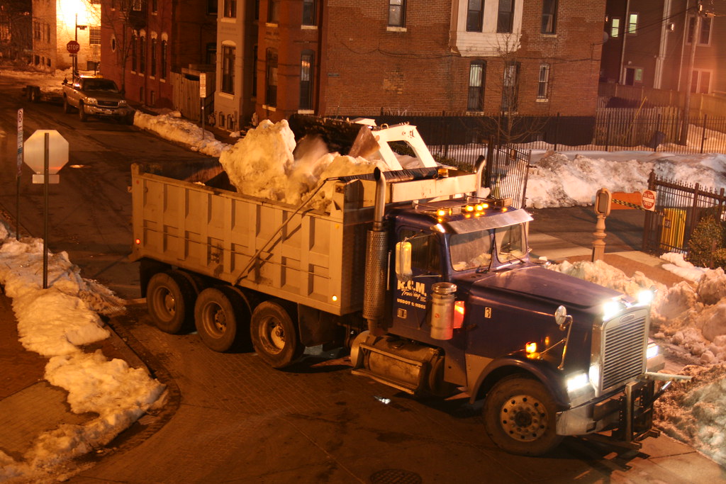
Snow Mountains Leaving
We wrote earlier about the mountains of snow that plows had piled up in LeDroit Park. Much of the city of Washington had become like the state of Washington, with snow-capped mounds visible from every window.
Welcome back east. We caught glimpses of bobcats and dumptrucks hauling away the snow mounds to lands far, far away.


Recent Comments