
More Snopocalypse
“Of course, the storm is the big story, it is unbelievable. It actually paralyzed Washington more than Joe Lieberman. In fact, there was so much white powder in D.C., people thought Marion Barry was mayor again.” — Jay Leno, Dec. 21, 2009
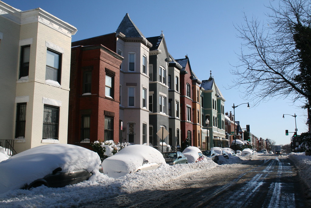
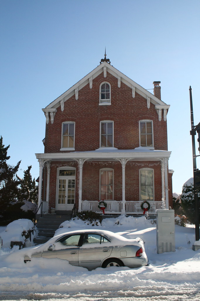
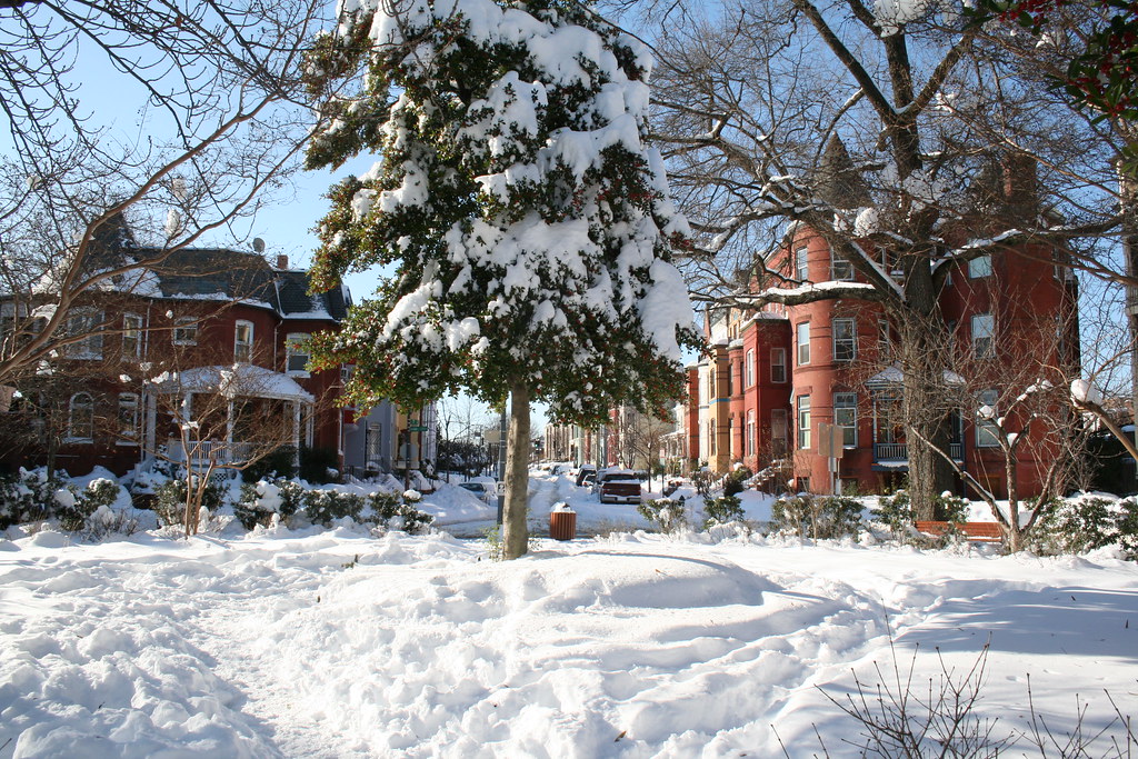
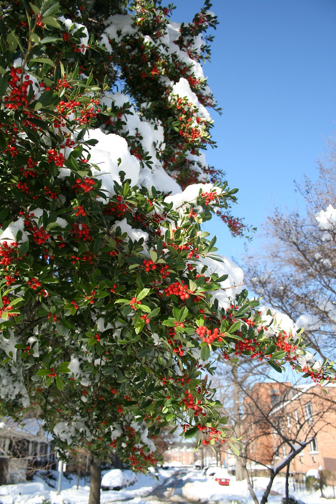
We turned on our camera to discover a few more photos of LeDroit Park after the Snowpocalyse that ended the weekend before Christmas. Enjoy. (Click each photo to view a larger version)
* * *
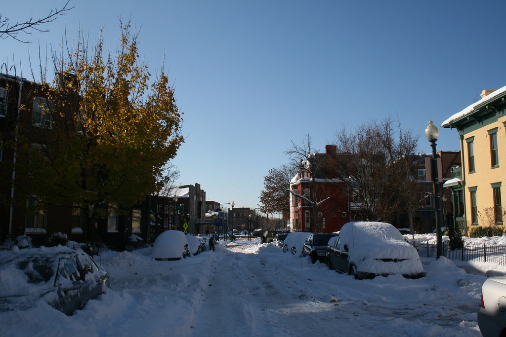
Looking south on Fourth Street:
Anna J. Cooper Circle under snow:
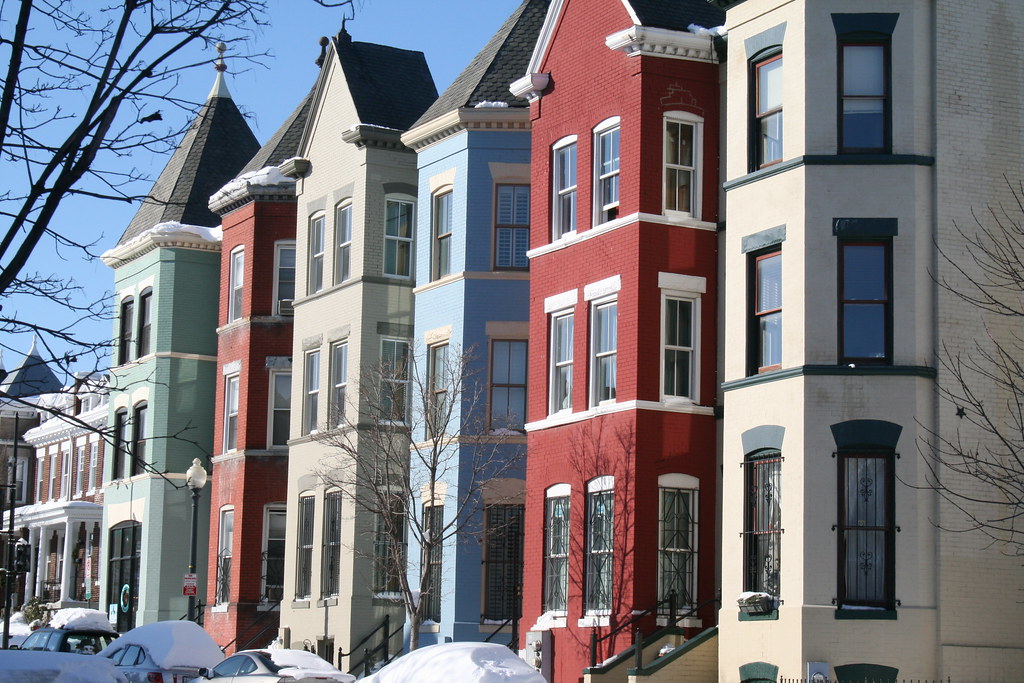
LeDroit Park’s own painted ladies:
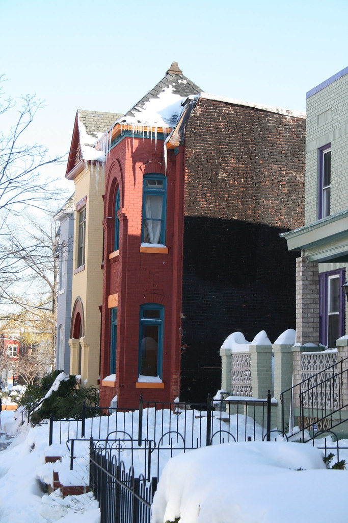
Icicles to kill!
View all our LeDroit Park photos— spring, summer, and fall, too!
Eye in the Sky (1988 – 2009)
What a difference twenty-one years make. Below are two satellite photos of LeDroit Park— one taken in 1988 and the other taken in 2009. Toggle back and forth between the two to see how the neighborhood’s footprint has changed.

There are a few noticeable changes:
- Howard University Hospital built an annex behind the main hospital building.
- The entire block bounded by Fourth Street, Fifth Street, V Street, and Oakdale Place is now a multi-level parking garage.
- In 1988, the 500 block of U Street looked gap-toothed; new houses have since been built to fill out the entire north side of the street.
- Street intersections have been replaced with concrete while the roadways remain asphalt.
- The tree canopy is much more expansive now (or the 1988 photo was taken in the winter).
- Houses have been built on the once-vacant land around the northeast corner of Fourth and U Streets.
- The intersection of T Street, Sixth Street, and Florida Avenue has been reconfigured, making way for the pocket park home to the LeDroit Park entrance arch.
- The Schoolhouse Lofts condo building has since been built at Second and V Streets.
Did we miss anything?
The Fall of the Billboards
Over in Shaw, the billboards at the intersection of Fourth Street, P Street, and New Jersey Avenue have been removed after the billboard’s owner, ClearChannel, reached an agreement with the District.
The Other 35 Percent details the billboards’ downfall. And there’s a video, too: (skip ahead to 2:30 and then to 4:25 to see the massive billboard crash to the ground.)
Old Street Names

Careful observers occasionally spot the old street signs adorning a few of the light poles in LeDroit Park. When the neighborhood was originally planned, most of the streets were named after trees. LeDroit Park’s street system didn’t fit with the L’Enfant Plan in either name or alignment—much to the dismay of the District commissioners—and the street names were eventually changed to fit the naming and numbering system.
A perusal of old maps reveals that the street names changed over time, not all at once. Elm Street is the only street that has retained its name. Since your author lives on Elm Street he has learned to respond to puzzled faces that know that Elm doesn’t fit the street naming system: “It’s kinda like U-and-1/3 Street”.
Anna J. Cooper Circle didn’t have a name at all until 1983, when it was restored to its circular form after a decades-long bisection by Third Street.
Just outside of LeDroit Park, the city renamed a few streets as well: 7th Street Road became Georgia Avenue and Boundary Street, the boundary of the L’Enfant Plan, became Florida Avenue.
Here is a table matching the current street names with their previous names.
| Old Name | Current Name |
| Le Droit Avenue | 2nd Street |
| Harewood Avenue | 3rd Street |
| Linden Street | 4th Street* |
| Larch Street | 5th Street |
| Juniper Street | 6th Street |
| Elm Street | (same) |
| Boundary Street | Florida Avenue** |
| 7th Street Road | Georgia Avenue** |
| Oak Court | Oakdale Place |
| Maple Avenue | T Street |
| Spruce Street | U Street |
| Wilson Street | V Street** |
| Pomeroy Street | W Street** |
| (unnamed before 1983) | Anna J. Cooper Circle |
| * For a short period, 4th Street was called 4½ Street. ** Though these streets were just outside the original LeDroit Park, we have included them for reference. |
|
Signs bearing the old street names have reappeared in the neighborhood, and according to the Afro-American, were put up in 1976: “The LeDroit Park Historic District Project was instrumental in getting the D.C. Department of Transportation to put up the old original street names for this Historic District Area under the present street name signs”.1
Unfortunately, some of the signs are showing their 33 years of weather, as this sign at Third and U Streets shows.

Eventually these signs will have to be replaced, but rather than placing the old names onto modern signs using a modern typeface, we suggest something that evokes the history without being mistaken for the current street name:

White text on a brown background is the standard for street and highway signs pointing to areas of recreation or cultural interest. Seattle started using the color scheme to mark its historic Olmsted boulevards and New York has long used the combination for street signs in its historic districts. The adoption of this style of sign would alert visitors and residents to the neighborhood’s historic identity while the different color and typeface would prevent confusion with the actual street names (U St NW in this case). Typographers would be pleased by the use of Big Caslon Medium, a serif typeface based on the centuries-old Caslon typeface.
- Hall, Ruth C. “Historic Project”. Washington Afro-American. 1 May 1976.


Recent Comments