
Help write history this Saturday
 The third meeting of the LeDroit Park-Bloomingdale Heritage Trail working group is Saturday. Attend if you’re interested in the history of our neighborhoods and would like to help bring the heritage trail to fruition.
The next meeting is Saturday, April 16 at 10 am at the office of the Howard University Community Association, 2731 Georgia Avenue.
In the coming months, Cultural Tourism DC, which sponsors the heritage trails, will collect all the interview transcripts and photographs and draft a series of trail markers like the one pictured right.
After neighborhood review, Cultural Tourism DC will install these markers throughout the neighborhoods marking locations of notable events, buildings, and residents.
Read the flyer for Saturday’s meeting.
Should DC allow more angle parking on Sunday mornings?
Councilmember Harry Thomas, Jr. (D — Ward 5) introduced a bill to ease Sunday parking tensions by permitting angle parking for religious institutions with ANC and DDOT approval. The councilmember held a forum on the bill and its companion commercial district bill last week.
In DC neighborhoods where street parking is at a premium, few things raise a resident’s ire like church congregants who park illegally on Sunday mornings. Congregants who drive from other parts of the District, from Maryland, and from Virginia have been known to double-park, park in alleys, block crosswalks, and block fire hydrants.
After receiving numerous complaints from residents, Mr. Thomas introduced the bill to primarily allay residents in Bloomindale and Eckington. Since these neighborhoods are among Ward Five’s most densely populated, they, like LeDroit Park, suffer from high street parking occupancy. Last week in Eckington, Mr. Thomas hosted a forum on his bills and took questions from residents.
Mr. Thomas acknowledged what residents have long known: parking enforcement around churches is intentionally lax on Sundays. Though Mr. Thomas admitted the unique challenges to transportation on Sunday mornings, he also decried congregants who park illegally, block residents in, and hinder public safety.
Transit service reaches its nadir on Sunday mornings, and churchgoers often travel to churches in residential neighborhoods with light Sunday service. Since transit service and car traffic are relatively low on Sunday mornings, Mr. Thomas thinks DDOT will be able to find instances of roadways wide enough to accommodate both angle parking and through traffic on Sunday mornings. In each case, though, DDOT will make the final determination of what is safe and permitted, even if an ANC supports the petition.

Left: typical curbside parking. Right: possible angle parking
We asked Mr. Thomas why he singled out angle parking and not other non-traditional parking arrangements and he admitted that the bill was just a first draft and could be expanded to include other measures.
For instance, DDOT permits parking beside the median on Sundays on the 1300 and 1400 blocks of New York Avenue NW downtown. This arrangement works since there is still one lane available for through traffic and since Sunday morning traffic flows are small. A similar arrangement might work along other multi-lane avenues in the District, including Rhode Island Avenue.
In other cases, solutions could be less radical. The congregants of several churches on Florida Avenue park in the right lane on Sunday morning even where parking is never permitted at any time. DDOT may be able to simply change the signs and permit curbside parking in such places on Sunday mornings. The extra parking can act as a traffic-calming measure, though, as we know, easier parking can induce more driving.
No matter what happens, the Department of Public Works, the primary agency in charge of parking enforcement, needs to end its practice of lax Sunday enforcement near churches. Only DDOT, not pastors and not congregants, should make the determination as to what constitutes safe Sunday morning parking. Mr. Thomas acknowledged that the law needs to be enforced uniformly as it is unfair to overlook, as one resident noted, illegal parking in residential neighborhoods, while actively ticketing illegal parking downtown on Sundays.
Though residents expressed frustration with some, though not all, neighborhood churches, Mr. Thomas rightly advised residents that parking tensions need not be adversarial. In fact, he called attention to instances in which neighborhood residents and churches collaborated to resolve parking problems. This can include urging pastors to rent unused lots for their congregants or to provide shuttle service from satellite lots or from congregants’ homes. He even touted bikesharing several times but said it is not practical for everyone.
Whatever the solution, Mr. Thomas admitted the bill was in its infancy and that he wants to provide a template for cooperation; angle parking may be one of many possible solutions.
Mr. Thomas was eager to mention the companion bill to allow permanent angle parking in business districts. Though most meeting attendees were there to complain about church parking in residential neighborhoods, Mr. Thomas said that many Ward 5 businesses depend heavily on customers arriving by private car. However, when he asked a local business owner how much of his business is from outside his neighborhood, the owner said that very little came from elsewhere.
The business corridor bill is significantly different from the Sunday parking bill. The former would permit businesses to seek diagonal parking at all times, regardless of transit service, or if the street space could be reallocated to bike lanes or wider sidewalks.
The Sunday parking bill carries more merit than the business corridor bill because of the unique circumstances of church locations and Sunday transit service. The business corridor bill, in contrast, too hastily and disproportionately prioritizes parking to the detriment of other road uses.
Free Wifi Coming to Bloomingdale
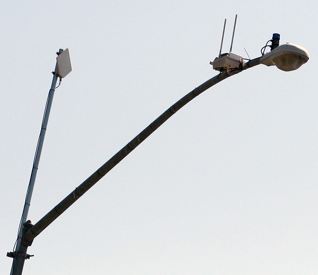
Photo by flick user niallkennedy
Cities have toyed with the idea of installing free wireless internet access as a way to bridge the digital divide. During the dot-com era, techno-evangelists fretted that the lack of internet access would further marginalize the poor in an increasingly digital world. Inexpensive wifi promises to close the gap by broadcasting free internet access at short ranges.
Over in Bloomingdale a plan has been brewing for several years to install a series of wifi antennae to broadcast internet to residents for free. Interestingly, the District’s Office of the Chief Technology Officer (OCTO) recently revealed that the city has indeed already installed wifi hotspots on the Mall. OCTO is partnering with Bloomingdale to bring the Bridge, as the program is called, to fruition.
The aptly named Bridge is expected to seep into parts of LeDroit Park and Eckington, too. Have a look at the proposed coverage map.
View The Bridge – Bloomingdale’s Free Wifi in a larger map
Heritage Trail for LeDroit Park and Bloomingdale

You’ve seen them around DC. Those tall signs with historic photos and narratives explaining what happened in that neighborhood 70 or 200 years ago. Several neighborhoods in DC have heritage trails, courtesy of Cultural Tourism DC.
We in LeDroit Park and Bloomingdale are on our way to getting our very own heritage trail, but the LeDroit Park-Bloomingdale Heritage Trail Working Group needs your help.
The Working Group will meet on Wednesday, May 12 at 7 pm at St. George’s Episcopal Church (Second & U Streets) to collect stories, old photos, and to plan how to interview our neighborhoods’ long-time residents.
Do you have an old photo or an old story to tell or are you interested in local history? LeDroit Park has hosted many notable residents from Civil War generals, to Duke Ellington, to Walter Washington, and even Jesse Jackson!
Come join us Wednesday night and learn how you can help.
Wednesday, May 12
7 pm
St. George’s Episcopal Church
Second & U Streets NW
Bloomin’ Road Rage
The driver of a car intentionally hit a cyclist at First Street and Florida Avenue NW in Bloomingdale, TheWashCycle reports. The victim wrote:
Around 5:50 PM [Wednesday] I was riding along First St. NW with other commuters. We crossed over Florida Ave and a car came in behind me, horn continuously on, and accelerated into my rear wheel knocking me to the ground. The driver then got out of the car and yelled some obscenity at me. He got back into his car and left the scene.
I ended up with a few bruises and bumps but luckily no serious injury, but my rear wheel was destroyed along with my saddle, still not sure about the frame. Although there were seven plus witnesses, we were only able to get a partial license plate. We did get a great description of the car. The police arrived on the scene and took all the witness statements, etc and the incident will be filed as a hit and run.
Using a vehicle as a weapon is a serious crime. It’s also important to remember that cyclists and drivers are equally entitled to use the streets of the city.
Old Maps: The District Before LeDroit Park (1792 – 1859)
This is the first in a series of posts about historic maps of LeDroit Park.
When the Federal Government established the national capital, it was to be located within a 100-square-mile diamond straddling both sides of the Potomac. In fact, the City of Washington was just one of several established cities and settlements in the nascent Federal District, later called the District of Columbia. The City of Washington, as defined by Congress and Peter L’Enfant’s plan, was bounded by the Potomac River and Rock Creek to the west, the Anacostia River to the south and east, and by Boundary Street (now Florida Avenue) to the north. LeDroit Park sits just north of Florida Avenue, in what was originally the rural Washington County, District of Columbia. The District also included the City of Georgetown, the City of Alexandria, and Alexandria County (now Arlington County, Virginia).
The map below, dating from 1792, was the first printed version of the L’Enfant Plan (as amended by Andrew Ellicott) for the City of Washington. Notice that its northern boundary coincides with what is now Florida Avenue. LeDroit Park now sits just to the west of what is marked as “Tiber Creek”. The creek, also called Goose Creek before the founding of the city, originally ran between First and Second Streets NW through Bloomingdale all the way to what is now Constitution Avenue NW, and westward toward the Washington Monument grounds, where it emptied into the Potomac River. Much of the creek is now buried in pipes beneath the city.
 Download the full version of this map from the Library of Congress
(We have a reliable method of identifying the future LeDroit Park on old maps of Washington: look for New Jersey Avenue NW, which runs diagonally to the northwest from the Capitol. Directly north of where it ends at the city’s border is where LeDroit Park would later be built.)
The capital city grew slowly over the coming decades with new residents, including government workers and Members of Congress, housed in newly constructed houses and boarding houses near the White House and Capitol, respectively. The difficulty in finding enough skilled labor to build a capital city required the leasing of slaves, who were instrumental in constructing many of the grand public buildings that stand today.
It would be a mistake to look at the map above and assume that all the new streets and canals were built together. In fact, the L’Enfant Plan was just that, a plan. The grand, spacious avenues required the clearing of trees and brush after a tedious survey to match the ground with the map.
In fact, by 1842 so much of the city was incomplete that a visiting Charles Dickens belittled Washington as a “city of magnificent intentions” marked by
spacious avenues, that begin in nothing and lead nowhere; streets, mile-long, that only want houses, roads, and inhabitants; public buildings that need but a public to be complete; and ornaments of great thoroughfares, which only lack great thoroughfares to ornament.
Whereas the global financial markets of today allow developers to develop large tracts of land at once, 19th-century cities had to be built piecemeal with speculation limited to small projects. LeDroit Park was no different: only several houses and only a few streets were built at first with the rest to come later.
From 1856 to 1859, German cartographer Albert Boschke charted the District hoping to sell his maps to the U.S. Government. His 1859 map of the City of Washington (below) provided illustrative evidence supporting Charles Dickens’s sneer. Much of Washington, especially its northern reaches near what was to become LeDroit Park, sat undeveloped with only a few cleared streets.
") Download the full version of this map from the Library of Congress. To aid orientation, we have superimposed a few street names.
Download the full version of this map from the Library of Congress. To aid orientation, we have superimposed a few street names.
The only clear north-south street was Seventh Street, which connected the city with the rural county and stretched into Maryland (albeit under different names). At R Street— if one could call it a street— it crossed an open creek that ran through the right-of-way.
Seventh Street’s primacy as the main north-south thoroughfare actually contradicts the intention of the L’Enfant Plan, whose Baroque determination to provide a “reciprocity of sight“, plotted Eighth Street, not Seventh Street, as the more important axis. In fact to this day the right-of-way of Eighth Street is fifteen feet wider than those of Seventh and Ninth Streets, even though Eight carries only a fraction of the traffic burden that the parallel streets carry.
It is difficult to enforce one artistic vision on a democracy; the shifting of axes, from Eighth to Seventh, merely reflects the fact that cities are shaped by their inhabitants in ways the founders never anticipate. The future LeDroit Park was no different.
Next: Alfred Boschke maps the entire District and a future LeDroit Park resident prints it, only to have it seized at gunpoint.
Where is Truxton Circle?

Truxton Circle, Lincoln Road is at the top of the photo.
You’ve seen the streetpole banners on Florida Avenue designating the area around North Capitol Street as Truxton Circle. But exactly where is the circle? The circle, pictured above, used to sit right there at the convergence of North Capital Street, Florida Avenue, Q Street, and Lincoln Road.
Urban planning blogger Richard Layman spotted a diagram of the old circle posted on the wall at the offices of DDOT.

Truxton Circle Diagram, Source: Richard Layman
In 1940 the District removed the circle and replaced it with a traditional intersection that failed, and continues to fail, to match the elegance of the original circle pictured at the top of this post.
A quick perusal of the DC Atlas, the District’s main online map product, reveals the circle’s imprint on the properties just north of Florida Avenue. It seems that the property lines still accommodate the circle.

Great Truxton's ghost! Proptery lines still show outer limit of the old circle.
Perhaps DDOT will one day resurrect the circle after its seventy-year absence. In 2006, DDOT restored downtown’s Thomas Circle to its original shape, eliminating the almond-shaped cut-through for Fourteenth Street. In the 1980s the District similarly restored Logan Circle, eliminating the Thirteenth Street cut-through. Here in LeDroit Park, Third Street bisected Anna J. Cooper Circle until the District in 1984 restored it to its original circular shape.
DC Homicide Rates Decline, Still Too High

We were walking through Columbia Heights late Saturday night and noticed numerous police cars rushing south toward Columbia Road. Later that evening we learned the terrible news that a nine-year-old boy was murdered in his apartment by one bullet shot through his front door. Though the assailant may not have been aiming for the boy specifically, shooting anywhere in an apartment building is bound to hurt somebody and we have serious trouble understanding why someone would exhibit such reckless disregard for human life.
This murder occurred despite this increased police presence this weekend as part of the MPD’s All Hands on Deck program. The police, though, cannot be in every hallway in every apartment building.
Closer to home, we became aware of a violent attack that occurred at Second and S Streets in Bloomingdale last week. In an email to the police and several community leaders, Former ANC Commissioner Margot Hoerrner (ANC1B11) described what happened to her friend Brad, who was house-sitting for her:
On Wednesday, at 5pm, Brad was attacked by 6-7 young men, at the corner of 2nd and S Street, who wanted absolutely nothing other than to beat the utter crap out of him. Brad, aside from being a military guy, is also an urban-savvy guy, who said that his instincts never warned him that something was about to happen. On his way to the Big Bear Cafe, half the group rushed him from the front, whereas the other half rushed him from the back. They knocked him down, and then, as a group, stomped on him, jumped on him, and beat him senseless, leaving him with black eyes, thoroughly bloodied and with several cracked ribs.
What’s shocking is that there are too many Washingtonians who think nothing of brutally beating and stomping innocent people.
Ms. Hoerrner added something I’ve often felt: that Washington is more dangerous than many conflict zones and poverty-stricken countries around the world:
As an aside, my work takes me to the poorest, conflict-riddled places in the world. I have spent the last two weeks in Kenya and Tanzania, which are at the precipice of humanitarian and civil disaster because of a four-year drought. A friend of mine has commented on my lack of fear in traveling to these places by myself, and asked me if I’ve ever felt fear traveling anywhere – and I said yes… I have felt more threatened and fearful living in Washington DC than I have anywhere else in the world. I am often stunned at the level of violence and crime that we have come to accept as a given for simply living in this city.
We bring up these problems because we feel that we as a city have become too used to this violence, which is actually abnormal. Washington’s homicide rate for last year was around 32 murders per 100,000 residents, still far off from the 1991 peak of 80.6, but far above the national average (5.8) and more than five times the rate of New York City (6.2).
Making Washington a world-class city requires addressing some of the sicker aspects of our civic culture, particularly our extraordinary rates of violence and our tolerance of violence. We should stand as examples of what a city can be: the elegant, prosperous, and peaceful pinnacle of human civilization and not a place bleeding from occasional bouts of unrelenting brutality.


Recent Comments