
Going for a Record
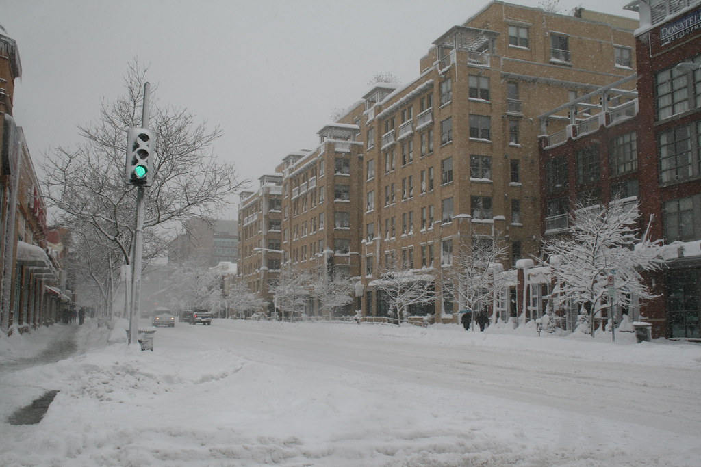
The record snow that accumulated this weekend brought us out to snowball fights and sledding in Meridian Hill Park. With few stores open and few roads passable, Saturday was a true holiday in the old-fashioned sense.
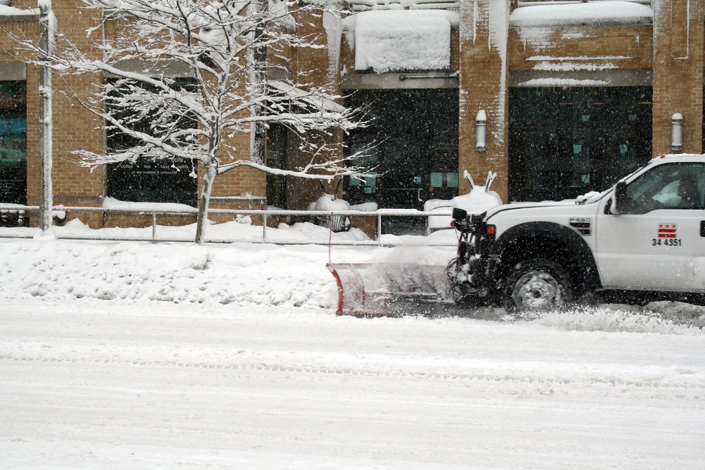
Howard University Hospital’s groundskeeper was out in heartbeat clearing the hospital’s sidewalks while contractors cleared the hospital’s parking lot. Pretty impressive!
Neighbors dug their cars out of snow and the usually busy Florida Avenue carried more pedestrians then automobiles. The District government sent numerous plows along U Street and Florida Avenue, largely neglecting (understandably) the quiet streets of LeDroit Park.
You didn’t need a 4×4 to get around this weather. These two girls found that a daddy-powered sled was the most convenient form of transportation.

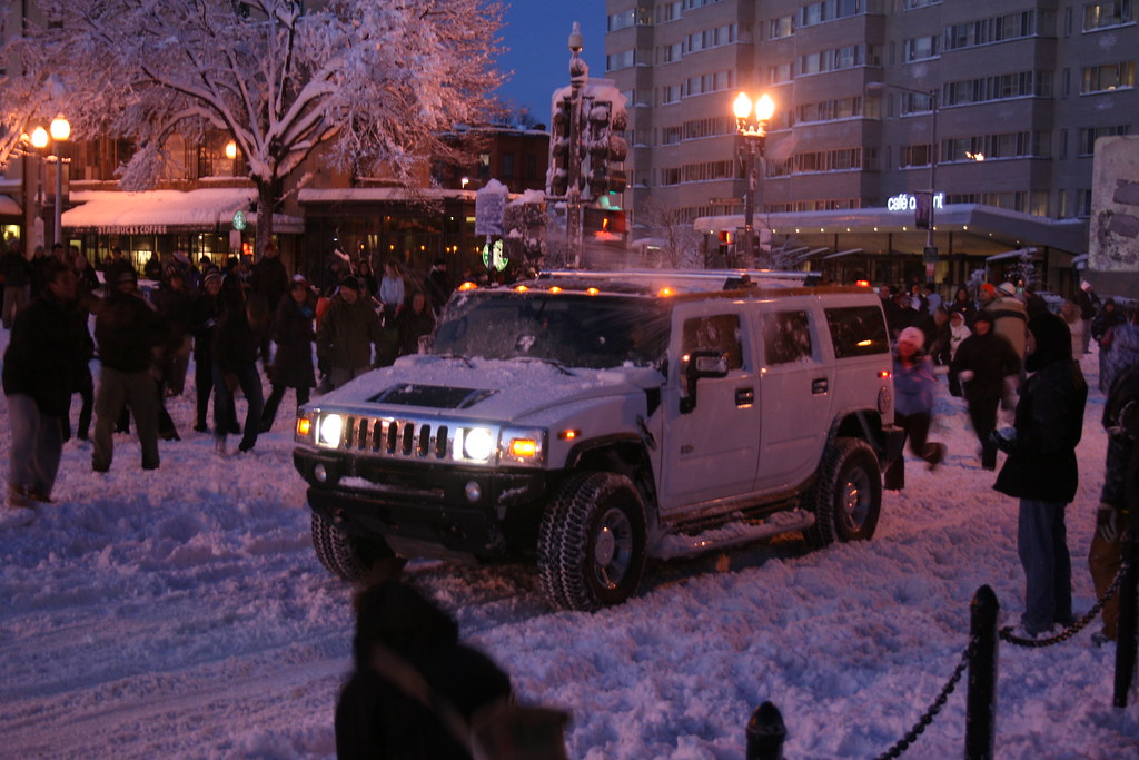
In Dupont Circle, hundreds of people gathered for a snowball fight. We caught the end of it:

Is a white Hummer camouflaged when it’s in the snow? These snowballers were able to spot and pelt it.
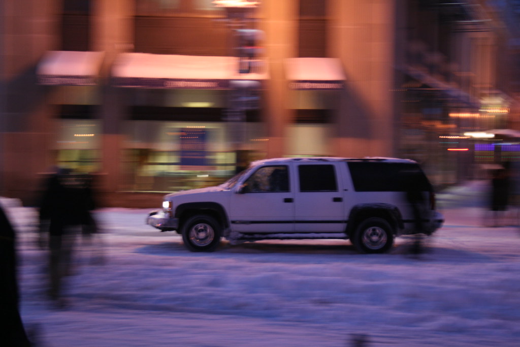
This Suburban sped away as soon as the light turned green.
For cars in LeDroit Park, Fourth and Fifth Streets are passable, but the east-west streets are better left to the four-wheel-drives.
More snow is expected Tuesday night and during the day on Wednesday. Were Pres. William McKinley still alive today, he would not only argue the merits of a gold standard with Rep. Ron Paul, but would also scoff at this relative “dusting”. Though we’ve recorded 45 inches so far this winter, the winter of 1898-99, during McKinley’s administration, set the city’s record, dumping a total of 54.4 inches on the capital!
If you’re tired of the snow, be glad you don’t live in Québec City, which suffers 124 inches of snow each winter… on average!
Flashback 1958: U & Ninth Streets
Yesterday we featured a flashback of an intersection near the 9:30 Club. Well, now we’re at Florida Avenue, Ninth Street, and U Street in 1958. Again, the photo is from DDOT’s historical archive.

The “Washington globe” streetlights, still manufactured today haven’t changed much from their 1958 predecessors, but the street signs have changed in style from a black-on-white serifed typeface to a white-on-green sans-serif typeface.
The DC Housing Finance Agency has replaced the building hosting Uptown Billiards. The building at the opposite corner, soon to be the Brixton Pub, appears to have been occupied in 1958. The emergency call box has been reoriented and fixed up somewhat and the traffic lights now extend over the roadway slightly. The crosswalks in 1958 were barely marked on the pavement.

Flashback 1958: Florida Avenue & V Street
DDOT’s historical photo archive contains this photo taken at Florida Avenue, Ninth Street, and V Street in 1958.
")
Here is the same view today.
")
Today one of the gas stations is gone, but several high-rises dot the skyline.
Eye in the Sky (1988 – 2009)
What a difference twenty-one years make. Below are two satellite photos of LeDroit Park— one taken in 1988 and the other taken in 2009. Toggle back and forth between the two to see how the neighborhood’s footprint has changed.

There are a few noticeable changes:
- Howard University Hospital built an annex behind the main hospital building.
- The entire block bounded by Fourth Street, Fifth Street, V Street, and Oakdale Place is now a multi-level parking garage.
- In 1988, the 500 block of U Street looked gap-toothed; new houses have since been built to fill out the entire north side of the street.
- Street intersections have been replaced with concrete while the roadways remain asphalt.
- The tree canopy is much more expansive now (or the 1988 photo was taken in the winter).
- Houses have been built on the once-vacant land around the northeast corner of Fourth and U Streets.
- The intersection of T Street, Sixth Street, and Florida Avenue has been reconfigured, making way for the pocket park home to the LeDroit Park entrance arch.
- The Schoolhouse Lofts condo building has since been built at Second and V Streets.
Did we miss anything?
Where is Truxton Circle?

Truxton Circle, Lincoln Road is at the top of the photo.
You’ve seen the streetpole banners on Florida Avenue designating the area around North Capitol Street as Truxton Circle. But exactly where is the circle? The circle, pictured above, used to sit right there at the convergence of North Capital Street, Florida Avenue, Q Street, and Lincoln Road.
Urban planning blogger Richard Layman spotted a diagram of the old circle posted on the wall at the offices of DDOT.

Truxton Circle Diagram, Source: Richard Layman
In 1940 the District removed the circle and replaced it with a traditional intersection that failed, and continues to fail, to match the elegance of the original circle pictured at the top of this post.
A quick perusal of the DC Atlas, the District’s main online map product, reveals the circle’s imprint on the properties just north of Florida Avenue. It seems that the property lines still accommodate the circle.

Great Truxton's ghost! Proptery lines still show outer limit of the old circle.
Perhaps DDOT will one day resurrect the circle after its seventy-year absence. In 2006, DDOT restored downtown’s Thomas Circle to its original shape, eliminating the almond-shaped cut-through for Fourteenth Street. In the 1980s the District similarly restored Logan Circle, eliminating the Thirteenth Street cut-through. Here in LeDroit Park, Third Street bisected Anna J. Cooper Circle until the District in 1984 restored it to its original circular shape.
Boutique Concept

We came across this proposal for Hartland Commons, a boutique hotel proposed for the site across T Street from the Howard Theater. We certainly think it’s a step up for what we have named the Block of Blight, but we’re not sold on the modern design and the destruction of some of the existing historic buildings.
Given that there’s no development application that we’re aware of, we suspect this is more of a conceptual design with no legs. The design, by Georgetown-based Group Goetz Architects, certainly contrasts with the neighboring architecture, though. Have a look.

View of the south façade along T Street

View from Duke Ellington Plaza at T Street and Florida Avenue NW

T Street façade, opposite the Howard Theater

T Street façade during the day.

Florida Avenue façade
While investigating the background of this project, we came across an earlier conceptual design by the same architecture firm, which, coincidentally, is located next to the Swedish Embassy. The façade resembles a fabric we’ve spotted at IKEA— perhaps “boutique hotel” is just a front the Swedish spy agency! If a motorcade of black Volvos emerges from the garage one day, don’t say we didn’t warn you.

Old Street Names

Careful observers occasionally spot the old street signs adorning a few of the light poles in LeDroit Park. When the neighborhood was originally planned, most of the streets were named after trees. LeDroit Park’s street system didn’t fit with the L’Enfant Plan in either name or alignment—much to the dismay of the District commissioners—and the street names were eventually changed to fit the naming and numbering system.
A perusal of old maps reveals that the street names changed over time, not all at once. Elm Street is the only street that has retained its name. Since your author lives on Elm Street he has learned to respond to puzzled faces that know that Elm doesn’t fit the street naming system: “It’s kinda like U-and-1/3 Street”.
Anna J. Cooper Circle didn’t have a name at all until 1983, when it was restored to its circular form after a decades-long bisection by Third Street.
Just outside of LeDroit Park, the city renamed a few streets as well: 7th Street Road became Georgia Avenue and Boundary Street, the boundary of the L’Enfant Plan, became Florida Avenue.
Here is a table matching the current street names with their previous names.
| Old Name | Current Name |
| Le Droit Avenue | 2nd Street |
| Harewood Avenue | 3rd Street |
| Linden Street | 4th Street* |
| Larch Street | 5th Street |
| Juniper Street | 6th Street |
| Elm Street | (same) |
| Boundary Street | Florida Avenue** |
| 7th Street Road | Georgia Avenue** |
| Oak Court | Oakdale Place |
| Maple Avenue | T Street |
| Spruce Street | U Street |
| Wilson Street | V Street** |
| Pomeroy Street | W Street** |
| (unnamed before 1983) | Anna J. Cooper Circle |
| * For a short period, 4th Street was called 4½ Street. ** Though these streets were just outside the original LeDroit Park, we have included them for reference. |
|
Signs bearing the old street names have reappeared in the neighborhood, and according to the Afro-American, were put up in 1976: “The LeDroit Park Historic District Project was instrumental in getting the D.C. Department of Transportation to put up the old original street names for this Historic District Area under the present street name signs”.1
Unfortunately, some of the signs are showing their 33 years of weather, as this sign at Third and U Streets shows.

Eventually these signs will have to be replaced, but rather than placing the old names onto modern signs using a modern typeface, we suggest something that evokes the history without being mistaken for the current street name:

White text on a brown background is the standard for street and highway signs pointing to areas of recreation or cultural interest. Seattle started using the color scheme to mark its historic Olmsted boulevards and New York has long used the combination for street signs in its historic districts. The adoption of this style of sign would alert visitors and residents to the neighborhood’s historic identity while the different color and typeface would prevent confusion with the actual street names (U St NW in this case). Typographers would be pleased by the use of Big Caslon Medium, a serif typeface based on the centuries-old Caslon typeface.
- Hall, Ruth C. “Historic Project”. Washington Afro-American. 1 May 1976.


Recent Comments