
It’s now a little easier to cross Florida Avenue at R Street
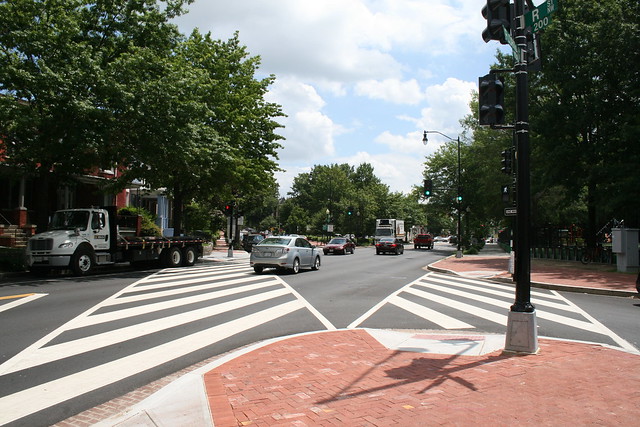
After much neighborhood lobbying, DDOT installed a new traffic signal at Florida Avenue and R Street NW in Bloomingdale. The light includes a pedestrian signal that will make it easier to cross Florida Avenue. Before DDOT installed the light, pedestrians had to pray that drivers on Florida Avenue would obey the law and yield at the crosswalks.

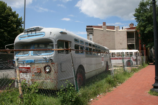
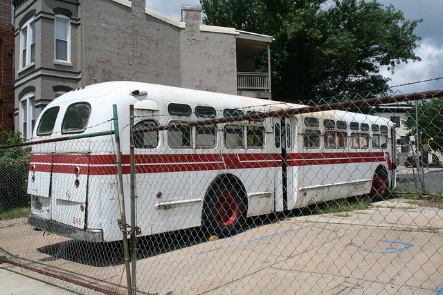
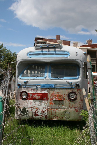
In unrelated news, two vintage transit buses are parked on the vacant lot at the northwest corner of the intersection.
Bikeshare expansion passes over LeDroit Park
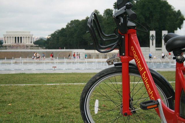
Capital Bikeshare, the District’s smashingly successful bikesharing system, will expand this fall. Unfortunately, the expansion plans for this fall exclude LeDroit Park.
The District and Arlington launched the system a year ago with 14 stations in Arlington and 100 in the District. This fall, DDOT will add 34 stations in the District. In our area, DDOT will add a station by the Shaw Library and another at 1st Street NW and Rhode Island Avenue NW in Bloomingdale.
These additions should help alleviate the pressure placed on the existing stations at 7th & T Streets NW in Shaw and at Florida Avenue and R Street NW in Bloomingdale. Currently, LeDroiters and Bloomingdalers compete to use these two stations and thus frequently leave the stations empty or full during rushhour.

Last week DDOT Director Terry Bellamy announced that the district will add 50 stations early next year. We hope that in this new round DDOT focuses more attention on LeDroit Park and other neighborhoods in ANC 1B.
For instance, a Capital Bikeshare station could easily go in at the Park at LeDroit’s south entrance at 3rd and Elm Streets NW. This location is central to the neighborhood and could bring some extra eyes to the park throughout the day.
Outside of LeDroit Park, there is a noticeable station gap in the northern reaches of Bloomingdale and around Cardozo High School.
Capital Bikeshare is particuarly successful in our part of DC for several reasons:
- Car ownership is relatively low compared to the rest of the nation, region, and city. This inclines people to bike more.
- Parking is particularly difficult on many neighborhood streets, thus making cycling more attractive.
- The historical development of this area has permitted the close proximity of commercial uses to residential uses. This means trips to shops and restaurants are short and easily made by bike.
- Downtown is a short ride away and biking is often faster than taking the bus.
Old Maps: The District Before LeDroit Park (1792 – 1859)
This is the first in a series of posts about historic maps of LeDroit Park.
When the Federal Government established the national capital, it was to be located within a 100-square-mile diamond straddling both sides of the Potomac. In fact, the City of Washington was just one of several established cities and settlements in the nascent Federal District, later called the District of Columbia. The City of Washington, as defined by Congress and Peter L’Enfant’s plan, was bounded by the Potomac River and Rock Creek to the west, the Anacostia River to the south and east, and by Boundary Street (now Florida Avenue) to the north. LeDroit Park sits just north of Florida Avenue, in what was originally the rural Washington County, District of Columbia. The District also included the City of Georgetown, the City of Alexandria, and Alexandria County (now Arlington County, Virginia).
The map below, dating from 1792, was the first printed version of the L’Enfant Plan (as amended by Andrew Ellicott) for the City of Washington. Notice that its northern boundary coincides with what is now Florida Avenue. LeDroit Park now sits just to the west of what is marked as “Tiber Creek”. The creek, also called Goose Creek before the founding of the city, originally ran between First and Second Streets NW through Bloomingdale all the way to what is now Constitution Avenue NW, and westward toward the Washington Monument grounds, where it emptied into the Potomac River. Much of the creek is now buried in pipes beneath the city.
 Download the full version of this map from the Library of Congress
(We have a reliable method of identifying the future LeDroit Park on old maps of Washington: look for New Jersey Avenue NW, which runs diagonally to the northwest from the Capitol. Directly north of where it ends at the city’s border is where LeDroit Park would later be built.)
The capital city grew slowly over the coming decades with new residents, including government workers and Members of Congress, housed in newly constructed houses and boarding houses near the White House and Capitol, respectively. The difficulty in finding enough skilled labor to build a capital city required the leasing of slaves, who were instrumental in constructing many of the grand public buildings that stand today.
It would be a mistake to look at the map above and assume that all the new streets and canals were built together. In fact, the L’Enfant Plan was just that, a plan. The grand, spacious avenues required the clearing of trees and brush after a tedious survey to match the ground with the map.
In fact, by 1842 so much of the city was incomplete that a visiting Charles Dickens belittled Washington as a “city of magnificent intentions” marked by
spacious avenues, that begin in nothing and lead nowhere; streets, mile-long, that only want houses, roads, and inhabitants; public buildings that need but a public to be complete; and ornaments of great thoroughfares, which only lack great thoroughfares to ornament.
Whereas the global financial markets of today allow developers to develop large tracts of land at once, 19th-century cities had to be built piecemeal with speculation limited to small projects. LeDroit Park was no different: only several houses and only a few streets were built at first with the rest to come later.
From 1856 to 1859, German cartographer Albert Boschke charted the District hoping to sell his maps to the U.S. Government. His 1859 map of the City of Washington (below) provided illustrative evidence supporting Charles Dickens’s sneer. Much of Washington, especially its northern reaches near what was to become LeDroit Park, sat undeveloped with only a few cleared streets.
") Download the full version of this map from the Library of Congress. To aid orientation, we have superimposed a few street names.
Download the full version of this map from the Library of Congress. To aid orientation, we have superimposed a few street names.
The only clear north-south street was Seventh Street, which connected the city with the rural county and stretched into Maryland (albeit under different names). At R Street— if one could call it a street— it crossed an open creek that ran through the right-of-way.
Seventh Street’s primacy as the main north-south thoroughfare actually contradicts the intention of the L’Enfant Plan, whose Baroque determination to provide a “reciprocity of sight“, plotted Eighth Street, not Seventh Street, as the more important axis. In fact to this day the right-of-way of Eighth Street is fifteen feet wider than those of Seventh and Ninth Streets, even though Eight carries only a fraction of the traffic burden that the parallel streets carry.
It is difficult to enforce one artistic vision on a democracy; the shifting of axes, from Eighth to Seventh, merely reflects the fact that cities are shaped by their inhabitants in ways the founders never anticipate. The future LeDroit Park was no different.
Next: Alfred Boschke maps the entire District and a future LeDroit Park resident prints it, only to have it seized at gunpoint.


Recent Comments