LeDroit Park in 1921
We were paging through the excellent online map collection of the Library of Congress and downloaded the 1921 Baist Real Estate Atlas of Washington, DC. This meticulous city atlas marked all the water mains, sewers, streets, squares, lots, and buildings. Buildings were shaded to indicate their construction materials (red for brick, yellow for wood). Subdivision names as well as the names of certain proprietors made their ways into the Baist maps, too.
We’re actually studying this atlas to do some research for an upcoming post on the zoning code, but for your convenience we’ve stitched together the three pages of the atlas covering LeDroit Park and Bloomingdale and published it as a single PDF document. Here are a few highlights.
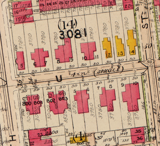
The 400 block of U Street, famous for its houses designed by Washington architect James McGill, reveals that the lots 12, 13, and 14 in square 3081 are wood houses, while all the other McGill houses on the block are brick.
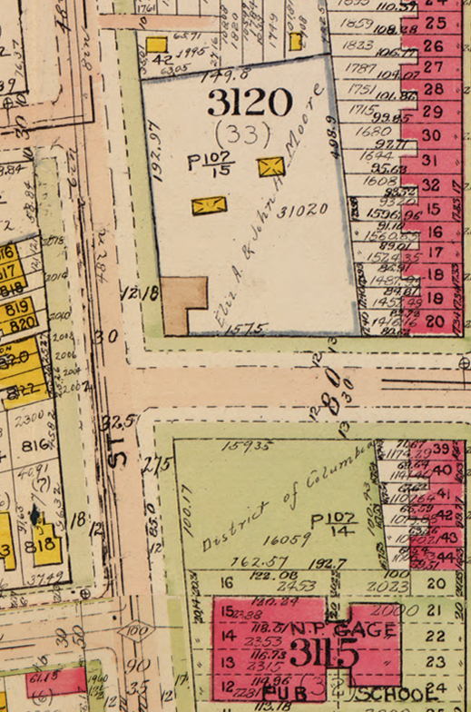
Here’s the original Gage School, now a condo building, on Second Street. Notice the Moore property, which predates the establishment of LeDroit Park, extending all the way south to Florida Avenue.
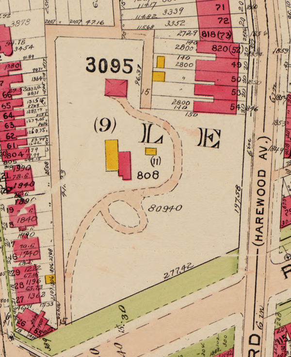
The current site of the United Planning Organization on Rhode Island Avenue was the estate of engraver David McClelland. As we wrote before, the U.S. War Department confiscated Mr. McClelland’s map of the District at the outbreak of the Civil War. The Elks later purchased the McClelland estate and eventually sold it and moved into their current building on Third Street (marked as Harewood Avenue below).
In the 1970s, the city razed all the area shaded in green below to make way for Gage-Eckington Elementary School, which was itself razed just last year after years of declining enrollment.


Wow, great find! Look at all the detached homes that used to line 3rd Street between Rhode Island and Elm Street. It must have been a gorgeous street back in the day. How on Earth were those existing boxy brick apartment buildings ever allowed to get built?! They are so out of character with the rest of the street/neighborhood. The red tape is certainly much thicker these days!
I might have to print this map out and take a walk around the neighborhood. I have to say that this blog site is by far one of my favorites in the city. I love the maps and historical articles. It would be interesting to see what the property looked like in photographs of the plot where that old Safeway stands.
Agreed with the previous poster…it is too bad that a lot of this was torn down and replaced with boxy brick buildings. I know some of them are dorms…but they are really an eye sore. Part of history too I suppose!