
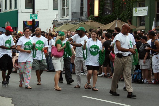
Ben Taylor chronicles U Street
We’ve been really busy lately and we have a big post reviewing Howard University’s campus plan in the works.
In the meantime, have a look at this Post video of Ben Taylor, a U Street photographer.
U Street’s worst pedestrian hazards will soon disappear
DDOT will begin reconstructing U Street this fall. Stretching from 9th Street to just short of 14th Street NW, the project’s first phase will fix many of the worst pedestrian problems with this street. Sadly, not being a Great Streets project, it isn’t getting some of the decorative touches of other projects like H Street NE.
Most of the details in the plan are the same as they were three years ago. A major theme is that the street will better accommodate pedestrians, especially those in wheelchairs. DDOT is guaranteeing a 4-foot-wide clearance throughout the project, and to do so the agency will eliminate parking spaces and driving lanes and move walls, street poles, and trees where necessary.
On the 1300 block, the staircases of three buildings on the south side currently make for a sliver of a sidewalk. Instead of trying to move or reconfigure the stairs, which are on public space, and instead of looking for an exception to the 4-foot clearance, DDOT will remove parking spaces and extend the sidewalk toward the travel lane.

Curb extension design for the 1300 block of U St. NW. Image from DDOT.
Additionally, the construction process itself is designed to minimize disruptions to pedestrians. The city will require its contractor to work on only one block at a time and will divert pedestrians to the parking lane when the sidewalks are being replaced.
Phase 1 will start in the fall and construction is expected to last 9 months. Phase 2, which stretches from 14th Street all the way to 18th Street, will start after phase 1 and the 18th Street reconstruction project are both finished.
In phase 1, the roadway will simply be milled down and resurfaced, a process that itself takes about 3 hours per block. The sidewalks will also be replaced except in front of the African-American Civil War Memorial and the Ellington, where they are very new. Phase 2 is more complicated, involving digging up the entire road bed, replacing a century-old water main, and rebuilding the entire roadway. The phase 1 section’s water main was replaced in the late 1980s with the construction of the Green Line, so the road work is less extensive there.
On the 1700 block, the north side’s sidewalk is notoriously narrow, poorly lit, and buckled by tree roots. DDOT will eliminate an eastbound driving lane on this residential block and redistribute the reclaimed area to both sidewalks.

Design for the 1700 block of U St. NW. Image from DDOT.
At the intersection with 16th Street and New Hampshire Avenue, the agency will include bulbouts (“B”) to reduce the street-crossing distances for pedestrians.

Design for the intersection of U St., 16th St., and New Hampshire Ave. NW. Image from DDOT.
Just east of the intersection and on the north side of U Street, the agency will remove an existing retaining wall (“A”) on the public right-of-way and rebuild it several feet back. This move will widen this otherwise narrow section of sidewalk.
The elimination of the slip lanes onto New Hampshire Avenue on both sides discourages speeding and creates small pedestrian plazas.
As we have documented before, some transportation departments are prone to neglecting pedestrians or expecting them to take needlessly long detours around construction. This will not be the case on U Street, much to the relief of pedestrians and business owners.
To minimize obstructions along the sidewalks, the city will install multi-space meters. This will be a good time to consider implementing performance parking for the U Street corridor, as parking becomes especially difficult on Friday and Saturday nights. The increased revenue could be used to improve and maintain the street amenities over the coming years, as is being done on Barracks Row.
The city will save street trees where it can and replant new trees in empty boxes and where trees cannot be saved.
While these improvements will enhance the experience for the many pedestrians who traverse the corridor, this reconstruction lacks many of the decorative design touches of some other projects around the city including the Great Streets projects.
U Street will receive the standard blue-gray concrete sidewalks instead of the beige, exposed aggregate concrete sidewalks now on H Street and currently being installed in Adams Morgan. H Street’s sidewalks enjoy pedestrian-scaled street markers etched in granite slabs embedded in the sidewalks. The metal street banners are another nice touch on H Street that won’t come to U Street under the current plan.
We can certainly add some decorative elements later, but the sidewalk pavement is something expected to last decades and must be done right the first time. With such a storied history, U Street deserves some of the qualities of a Great Street.
A Dunbar poem that LeDroit Park inspired
One of LeDroit Park’s notable residents was famed poet Paul Laurence Dunbar. Mr. Dubar lived at 1934 4th St NW with his wife Alice.
After Mr. Dunbar’s death, his widow, Alice, published an article analyzing his poetry. In it she noted that Spruce Street (now LeDroit Park’s segment of U Street NW) inspired the poem “Lover’s Lane”:
The white arc light of the corner lamp, filtering through the arches of the maples on Spruce street, make for the tender suggestion in “Lover’s Lane,” where the lovers walk side by side under the “shadder-mekin’ ”
Below we have reprinted “Lover’s Lane” followed by an old audio recording of Paul Robeson singing a hearty bass-barritone version of the Dunbar poem.
Lover’s Lane
SUMMAH night an’ sighin’ breeze,
’Long de lovah’s lane;
Frien’ly, shadder-mekin’ trees,
’Long de lovah’s lane.
White folks’ wo’k all done up gran’—
Me an’ ’Mandy han’-in-han’
Struttin’ lak we owned de lan’,
’Long de lovah’s lane.Owl a-settin’ ’side de road,
’Long de lovah’s lane,
Lookin’ at us lak he knowed
Dis uz lovah’s lane.
Go on, hoot yo’ Mou’nful tune,
You ain’ nevah loved in June,
An’ come hidin’ f’om de moon
Down in lovah’s lane.Bush it ben’ an’ nod an’ sway,
Down in lovah’s lane,
Try’n’ to hyeah me whut I say
’Long de lovah’s lane.
But I whispahs low lak dis,
An’ my ’Mandy smile huh bliss—
Mistah Bush he shek his fis’,
Down in lovah’s lane.Whut I keer ef day is long,
Down in lovah’s lane.
I kin allus sing a song
’Long de lovah’s lane.
An’ de wo’ds I hyeah an’ say
Meks up fu’ de weary day
Wen I’s strollin’ by de way,
Down in lovah’s lane.An’ dis t’ought will allus rise
Down in lovah’s lane;
Wondah whethah in de skies
Dey’s a lovah’s lane.
Ef dey ain’t, I tell you true,
’Ligion do look mighty blue,
’Cause I do’ know whut I’d do
’Dout a lovah’s lane.
7th & T was always the seedier end of the U Street corridor
This is the second in a series on the Scurlock photo archive. Read the first entry.
During the Jazz Age of the 1920s and later into the 1930s, U Street was dubbed the “black Broadway” as it featured such venues as the Lincoln Colonnade (now the Lincoln Theater), the Howard Theatre, and other clubs and restaurants. In a segregated city in which blacks were excluded from most restaurants, theaters, and stores, U Street served as a refuge to catch a show and enjoy a meal.
This photo from the Scurlock archives was taken looking east at 7th and T Streets NW in 1939.
[Toggling between now and then photos will not work in RSS readers. View the actual post]
We have referred to this area as the block of blight for its dilapidated buildings, copious litter, and frequent police arrests. It turns out that some things never change. Even when this photograph was taken, U Street was not uniform in character and the area around the Howard Theatre was considered downscale compared to the classier venues west on U Street. (For more on U Street’s evolution, see Blair Ruble’s recent book, Washington’s U Street: A Biography.)
Pictured here at the corner is National Grill, which, like Harrison’s Café in LeDroit Park, advertised itself as open all night. The lighted vertical sign attached to the façade appears to read “LUNCH” and the pediment at the cornice bears the building’s name, “Scott’s”. (View a larger version of the photo.)
Just to the right (south) of National Grill is the S.W. Keys Luncheonette, whose vertical sign advertises coffee and waffles. Just south of that is Harlem Cafe, located in a building that has since been replaced.
On T Street, just behind Scott’s Building and just before the Howard Theatre, you will see a sign that reads “BILLIARDS”. That marks Frank Holliday’s pool hall, a popular gathering spot for Howard scholars, jazz musicians, and city laborers alike. Duke Ellington captured the scene at the pool hall:
Guys from all walks of life seemed to converge there: school kids over and under sixteen; college students and graduates, some starting out in law and medicine and science; and lots of Pullman porters and dining-car waiters.
Just beyond the pool hall, you’ll see the Howard Theatre sporting its original Italianate façade. The theater was later covered with plaster, which was only recently removed for the restoration project.
Today the last two buildings on 7th Street are a Chinese take-out and a tiny market. One of the developers of Progression Place, the large development project underway on the block (rendering below), said that the late owner of these two buildings refused to sell to his development. Progression Place will incorporate every building on this block except for these two.
If anyone is looking for a two-building restoration project, here is your chance!

Progression Place will include all but the gray and orange buildings.
New Condos Coming to Shaw and 14th Street

Florida Avenue elevation for Douglas Development's proposal for 2221 Fourteenth Street NW
The monthly meeting of ANC1B will be on Thursday, December 2 at 7pm in the Reeves Building at Fourteenth and U Streets NW. Here are some of the highlights from the agenda:
Development/Public Space
The commission will likely support the zoning relief application for 2221 14th Street NW (image above). In a rare residential foray, Douglas Development seeks to build a condo building at the southeast corner of Fourteenth Street and Florida Avenue. The company is seeking support for several variances and special exceptions, mostly regarding the roof structure, rear setback, and parking requirements. View the designs and zoning application.
 The commission is also likely to lend its support to the Arts District Branding Project, which is developing graphic banners (sample at right) to hang from lights posts along Fourteenth Street and U Street. The banner is part of a $200,000 city-funded branding project to enhance the marketing and identity of the arts district that stretches along Fourteenth Street from Rhode Island Avenue to Florida Avenue and along U Street from Seventeenth Street to Seventh Street.
DDOT prefers that private groups obtain ANC support before the agency permits groups to hang banners on poles for 90 – 180 days. After the 180-day term, the banners remain up until another group wishes to use the poles or until the group removes them.
Also on the agenda is the District-owned Parcel 39 at the southwest corner of Eighth and T Streets in Shaw. The site is currently a parking lot, but Mayor Fenty, in the waning days of his mayoralty, is seeking to sell the lot to a development team with plans to construct a four-unit condo building. The sale price, or proposed sales price, has not yet been disclosed.
Alcohol Licenses
Two licensees are looking to modify their licenses:
Alero Restaurant & Lounge (1301 U Street) looks to amend its Class C license to include a 44-seat sidewalk café serving alcohol from 11:30 am to 1 am Sunday through Saturday.
Nearby, the Islander Caribbean Restaurant & Lounge (1201 U Street) wants to extend its hours and expand to the second floor. Currently their hours are Sunday 10 am- 2 am and Thursday-Saturday 10 am-2 am. They propose these new hours: Sunday through Saturday, 6 am-4 am with alcohol served Sunday 10 am-2 am, Monday-Thursday 8 am-2 am, and Friday – Saturday 8 am-3 am.
The commission will likely renew the following licenses as a formality:
- Duffy’s Irish Restaurant (2106 Vermont Avenue)
- Hominy/Bohemian Caverns (2001 11th Street)
- Dickson Wine (903 U Street)
- Velvet Lounge (915 U Street)
- Indulj (1208 U Street)
- Desperados Pizza (1342 U Street)
- Patty Boom Boom (1359 U Street)
- Marvin (2007 14th Street)
- The Gibson (2009 14th Street)
- Café Collage (1346 T Street)
- Jin (2017 14th Street)
Filming History
Mrs. Lauretta Jackson has lived in LeDroit Park since the 1940s. The Humanities Council of Washington DC, located in the white rowhouse at Vermont Avenue and U Street, sponsored this three-part interview with Mrs. Jackson. It’s truly a fascinating window into the neighborhood’s history. Mrs. Jackson explains the stories behind many of the neighborhood’s notable houses and details the neighborhood’s nineteenth-century birth.
Part 1:
Part 2:
Part 3
New Contraflow Lanes Open on New Hampshire Ave
DDOT just activated the new contraflow bike lanes on the two blocks of New Hampshire Avenue connecting from U Street. Cyclists traveling against the flow of car traffic now have separate lanes in which to travel all the way to the crossroads of U Street, Sixteenth Street, and New Hampshire Avenue.

At the intersection, DDOT has installed special bike traffic lights to allow cyclists to cross into the bike-boxes ahead of the queues of car traffic waiting on Sixteenth Street. (See the green bike-boxes ahead of the stop lines in the diagram above.)
This is a pilot project for DDOT and there are a few kinks to work out. First, the bike signals are not placed in ideal positions. Look carefully at southwest corner of the diagram above. Notice that a cyclist stopped at the stop line on New Hampshire Avenue does not directly face a bike signal. The cyclist must know to look to the right and to look up to heights that are unusual for bike signage. In much of the world, bike signals are placed five to seven feet above the ground. Even if the signals cannot be located to other poles, lowering them on their existing poles could help.
Second, there are induction loops embedded in the pavement to sense a waiting cyclist but there’s no indication that cyclists should wait exactly at the stop line in order to trip the sensor. While filming, we pulled to the curb to stop and failed to trip the sensor.
This is merely the first step in DDOT’s plan to reconfigure the intersection, which suffers a high number of pedestrian injuries. Until now, these two blocks of New Hampshire Avenue have been the missing link between New Hampshire Avenue and Sixteenth Street and the bike lanes on T and V Streets (eastbound and westbound, respectively).
See Fenty Run
Mayor Adrian Fenty (D) will address the monthly meeting of ANC 1B on Thursday at 7 pm at the Reeves Center at Fourteenth and U Streets NW. Following the mayor will be Councilmember Kwame Brown (D – at large), who is running for chair of the DC Council.
In other news, a new Mexican restaurant at 1819 Fourteenth Street, next to the Black Cat, is applying for a liquor license. They plan to host 99 seats in the summer garden, 14 seats on the sidewalk, and 161 seats inside. Though the property appears to be a modest 20 feet wide, it’s very deep and the “summer garden” is probably liquor license-speak for “roof deck”.
Closer to LeDroit Park, Howard Theatre Restoration Inc., the non-profit about to break ground on the Howard Theatre renovations this month, will request a $5,000 grant for the Jazz Man statue we wrote about earlier.
Update: We received word yesterday that the mayor has canceled his appearance.
Cab Crashes into House
A cab crashed into 408 U Street NW yesterday. According to a neighbor, a cab customer attempted to rob the cab driver, who then flipped out, ran over the curb, reversed in a panic and slammed into one of the McGill houses.
The culprit escaped and there’s no word on the state of the cab driver. The house appears to be unoccupied.
How LeDroit Park Came to be Added to the City
The following is a Washington Times article from 1903. The article explains some of the early history of the neighborhood and even includes three photos, the first of which was misidentified as Fifth Street, though we have actually matched it up with Second Street. We have included a few links to related information.

Second Street opposite the Anna J. Cooper House.
HOW LE DROIT PARK CAME TO BE ADDED TO THE CITY
Washington Times
Sunday, May 31, 1903For Many Years the Section of Washington Known by That Name Had Practically Its Separate Government and Had All the Characteristics of a Country Town, Although Plainly Within the Boundary Limits. * * *
In that portion of Florida Avenue between Seventh Street and Eighth Streets northwest where the street cars of the Seventh Street line and the Ninth Street line pass over the same tracks, thousands of passengers are carried every day, and probably but a few if any realize the fact that they are passing over a road older than the organization of the city, a road that dates back to the Revolutionary period— the Bladensburg Road, which connected Georgetown with Bladensburg before the location of the National Capital was determined.
The Map on the Wall.
If the people passing this point will note the little frame building occupied by a florist, 713 Florida Avenue northwest, they will observe that in front of these premises and fastened to the blacksmith shop adjoining is a goodly sized signboard on which is painted an old map of this section and showing the intersection of the old Blandensburg Road and Boundary Street, now known as Florida Avenue. From this map it is seen that Seventh Street Road [now Georgia Avenue] intersects Boundary Street and the old Bladensburg Road at a point about 100 feet east of where the two roads join at an acute angle, and glancing along the lines of Boundary Street and the north lines of some buildings which have been erected in this angle we easily see the direction of the Bladensburg Road and discover that the small building 713 Florida Avenue northwest marks the spot where the Bladensburg Road deflected from Boundary Street and bore off in a northeasterly direction toward Bladensburg.
Once Part of Jamaica Vacancy.
The map referred to is said to be a portion of [the estate named] Jamaica and and Smith’s Vacancy, but if we examine the plats in the office of the Surveyor of the District we will hardly find on file any plats of those sections, but may learn that Le Droit Park was once part of Jamaica and Smith’s Vacancy and possibly a portion of [the estate named] Port Royal. Prior to the cession of the territory now included in the District from Maryland the land known as Jamaica was owned by one Philip R. Fendall, of Virginia. He conveyed this tract of 494 acres on the 12th day of January, 1792, to Samuel Blodgett, jr., of Massachusetts, and from this point the title of the land can be traced down to the present time.
The names attached to the different vacancies establish the names of the various owners of lands adjoining Bladensburg Road at the time it was abandoned as a thoroughfare and taken up as a portion of the farms in that section, and the presence of this old road accounts for some of the peculiar lines in some of the northern boundaries of some of the lots in Le Droit Park. This road crossed Second Street at a point north of Elm Street here. The old plats show Moore’s Vacancy. The road finally joined the present road to Bladensburg at a point where the sixth milestone of the norther line of the District was located.
It is probable that this peculiarly natural boundary of some of the lands which afterward became Le Droit Park may have had something to do with the strange lines which are found in the streets of that suburb, although it was not the intention at the time that Le Droit Park was subdivided to have the streets conform with the city streets.
Site of Campbell Hospital.
During the civil war the territory now contained in Le Droit Park was used as the site of Campbell General Hospital, one of the important hospitals near Washington. The hospital comprised some seventeen separate wooden buildings, erected in the form of a hollow square, with the central portion divided into irregular spaces by buildings cutting across the inclosure and connecting the outside buildings.
The larger dimension of this hospital was fro north to south, and extended from Boundary Street, now known as Florida Avenue, on the south, to the land occupied for many years as a baseball park, situated south of Freedman’s Hospital, and designated on some of the old maps as Levi Park. From east to west the hospital covered the ground from Seventh Street to what is now known as Fifth Street in Le Droit Park, and it is possible that a portion of the space between Fifth Street and Fourth Street was also included in the hospital inclosure.

The McClelland Residence.
At this time there were only two dwellings in the tract known afterward as Le Droit Park— the McClelland and Gilman homestands. Each included about ten acres of land used for grazing and garden purposes. The McClelland property and the Gilman property were divided by a row of large oak trees which were situated about fifty feet apart and continued from Florida Avenue, then Boundary Street, to the northern line of the park.
[See the following 1861 map, a map we extolled several months ago:

]
To the east of the Gilman tract was a narrow strip of land known as the Prather tract. East of this was Moore’s Lane, now Second Street, and still to the east was the tracts of the Moores, George and David, covering the territory as far east as the present location of Lincoln Avenue [now Lincoln Road], on which was located Harewood Hospital, another hospital of considerable note during the civil war.
T.R. Senior, who was commissary at Campbell Hospital, returned to the city some twelve years after the war closed and purchased a residence at the corner of Elm and Second Streets, where he now resides. Members of the family of David McClelland now occupy the old homestead on Second Street.
Following the close of the war it became necessary to provide for such of the freedmen as were in need of assistance. Campbell General Hospital was occupied by the freedmen until August 16, 1869, when the patients were transferred to the new Freedman’s Hospital, which has been erected in connection with Howard University.
The property upon which Freedman’s Hospital stands consisted of a tract of 150 acres and was purchased from John A. Smith. In April, 1867, Howardtown was laid out and soon after some 500 lots were sold, and at this time it seems that the idea was conveyed that streets would be opened to the south through the Miller tract. In April, 1870, the Howard University purchased the Miller tract, and laid out streets to connect the streets of Howardtown with the city streets, and a little later built four houses on the line of what is now known as Fourth Street and in 1872 subdivided the Miller tract, but for some reason the plat was not recorded.
In 1873 the Miller tract was sold by Howard University to A[ndrew] Langdon, and a short time afterward A[mzi] L[orenzo] Barber, formerly secretary of Howard University, became associated with Langdon and hs partner, and by arrangements with D[avid] McClelland, all of the three tracts known as the Miller tract, the McClelland tract, and the Gilman tract were united and subdivided, and in June, 1873, a subdivision known as Le Droit Park was placed on record in the surveyor’s office. A subsequent plat was filed some eighteen months later, in which the proprietors of the subdivision declared it to be their purpose and intention to retain and control the ownership of all the streets platted, and the right to inclose the whole or any portion of the tracts or tract included in the subdivision and to locate and control all entrances and gates to the same.

During the autumn of 1876 A. L. Barber & Co. commenced the erection of fences across the north line of Le Droit Park, and from this time until August, 1891, fences were maintained along the northern line of the park. From 1886 to 1891 frequent fence wars were in operation. The fence across what is now Fourth Street would be removed by one party, and the opposing party would secure an injunction and restore it. This mode of procedure was repeated at various times until in 1901 a compromise verdict was agreed upon by the two factions and the fence was removed, Fourth Street was improved north of the park, and the streets of the park passed into the control of the city after a period of some eighteen years of private ownership.
The organization of Le Droit Park, under the limitations of the plat filed in 1873, was a peculiar experiment, that of the founding of an independent suburb adjoining the city. the southern line of the park was inclosed with a handsome combination iron and wood fence, some of which may now be found on the southern line of the McClelland property. Buildings were erected with plenty of room around them, and during the period from 1873 to 1885 the larger part of the buildings were planned and erected by James H. McGill. Double houses were quite common, but it was not until 1888 that such a thing as a row of houses were known in the park.
Before control of the streets was surrendered to the city the conditions existing in the park resembled closely those found in small country towns. Many of the inhabitants owned cows, which were pastured upon the vacant lots; the women “went a-neighboring,” and the social life savored strongly of a village, and yet it was near the city. The express and telegraph messengers, however, always collected of residents an extra fee for the reason that they lived out of the city.
With the opening of the streets and the introduction of street cars the park soon lost its former characteristics and became part of the city with all of its advantages and disadvantages. The opening of Rhode Island Avenue [from Florida Avenue eastward] spoiled in a measure the former beauty of the McClelland and Gilman homesteads, although there is still much more ground remaining in both of these old tracts that many people would care to own. The opening of Fifth Street will, to some extent, divide the traffic which now finds a way through Fourth Street. Sixth Street ends at Spruce Street [now U Street], and further progress seems barred by the residence, 601 Spruce Street, and there seems no immediate chance of the extension of Third Street above its present limit [at V Street??], where progress is barred by a high fence decorated with the advertisement of a prominent firm.
Former Familiar Street Names.
The old names of the streets of the park, such as Harewood Avenue [now Third Street], Maple Avenue [now U Street], Moore’s Lane [later Le Droit Avenue, then Second Street], Linden Street [now Fourth Street], Larch Street [now Fifth Street], Juniper Street [now Sixth Street], and Bohrer Street [still extant], are nearly forgotten, and have passed away with the fence and its period. The names of the city streets have taken their places, and with the growth of the population the country life and country scenes have given way to those of the city.


Recent Comments