Where is Truxton Circle?
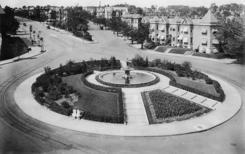
You’ve seen the streetpole banners on Florida Avenue designating the area around North Capitol Street as Truxton Circle. But exactly where is the circle? The circle, pictured above, used to sit right there at the convergence of North Capital Street, Florida Avenue, Q Street, and Lincoln Road.
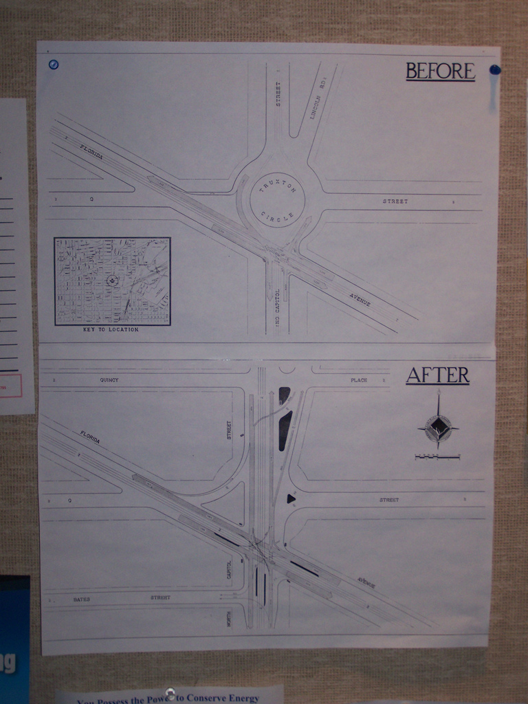
Urban planning blogger Richard Layman spotted a diagram of the old circle posted on the wall at the offices of DDOT.
In 1940 the District removed the circle and replaced it with a traditional intersection that failed, and continues to fail, to match the elegance of the original circle pictured at the top of this post.
A quick perusal of the DC Atlas, the District’s main online map product, reveals the circle’s imprint on the properties just north of Florida Avenue. It seems that the property lines still accommodate the circle.
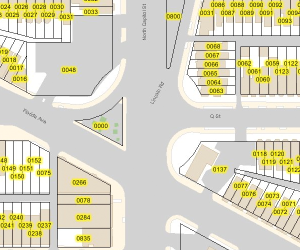
Great Truxton's ghost! Proptery lines still show outer limit of the old circle.
Perhaps DDOT will one day resurrect the circle after its seventy-year absence. In 2006, DDOT restored downtown’s Thomas Circle to its original shape, eliminating the almond-shaped cut-through for Fourteenth Street. In the 1980s the District similarly restored Logan Circle, eliminating the Thirteenth Street cut-through. Here in LeDroit Park, Third Street bisected Anna J. Cooper Circle until the District in 1984 restored it to its original circular shape.
The Streetcars Have Landed
We wrote earlier about the rebirth of DC’s streetcar system and even suggested our own alignment for a full-length Rhode Island Avenue line.
As we reported, the city’s three streetcars were collecting dust in the city of Plzeň in the Czech Republic, where they were manufactured. Today they completed their transatlantic voyage and landed at the Port of Balitmore. DDOT recorded the event:
The streetcars will be transported to the Greenbelt Metro railyard, where WMATA staff will maintain them until the tracks are ready.
Speaking of tracks, DDOT has finished laying down the streetcar tracks along Benning Road in Northeast.

DDOT took this photo on Benning Road NE at 17th Street NE, just two blocks outside the L’Enfant Plan, where overhead catenery wires are prohibited by law— another issue DDOT will have to resolve.
DDOT is ambitiously moving ahead with the streetcar plan, but Councilmember Jim Graham (D – Ward 1) told us that though he may not see the streetcars in his lifetime, I’d see them in mine (you’re writer is 25). Not fully reassuring, but better than nothing.
I Saw the Sign
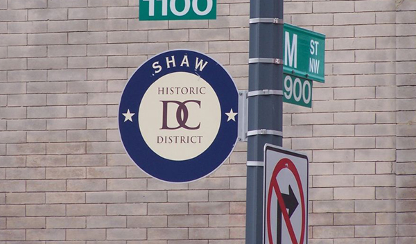
The DC Historic District markers adorning lampposts in Shaw, Anacostia, and Capitol Hill are coming to LeDroit Park— eventually.
The Office of Historic Preservation informed us today that the signs, for which the office has already paid, will adorn every historic district when DDOT decides to dust them off and install them.
Bike Sharing
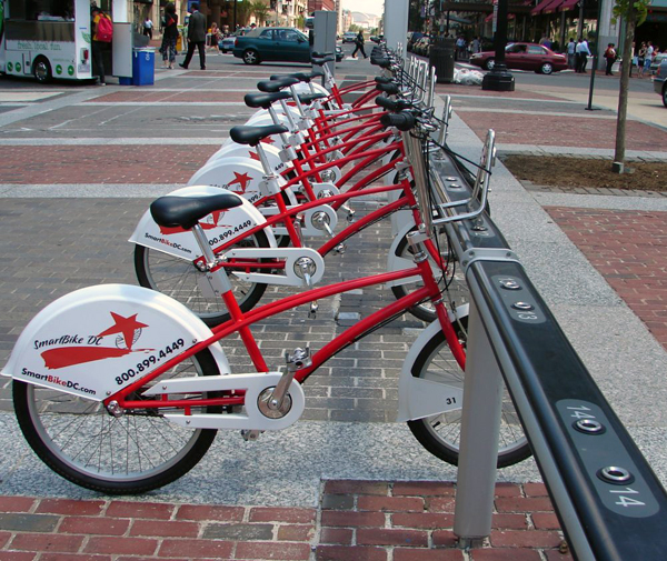
One wonderful feature of living in LeDroit Park is not only its proximity to downtown, but the variety of options in getting downtown.
A cab ride to Chinatown is only about $5.50. A walk is only 25 minutes. The Green and Yellow lines stop at 7th and S Streets in Shaw. Numerous buses run along 7th Street and Georgia Avenue toward downtown. For those of us who can’t tolerate the 70s buses that stop every block, the limited-stop 79 stops at 7th and T Streets, just two stops before downtown.
Yet there is another frequently overlooked option: picking up a SmartBike at 7th and T Streets and riding downtown to another bike station.
SmartBike was established by the advertising company Clear Channel Outdoor as a quid-pro-quo for having the right to advertise in the city’s bus shelters. For a flat, annual $40 fee, subscribers receive an RFID card (just like a SmarTrip card) that they wave at a station, which then unlocks a bike in response. A member may use the bike for up to three hours and can return it to any station.
When the weather is nice, your author frequently picks up a bike at 7th & T Streets and rides it to work near Metro Center. He returns it to a station located on his office’s block at 12th and G Streets (across the street from Macy’s). Since the cost is a flat $40 per year, there is no additional cost for each ride.
DDOT, which pushed Clear Channel for this program, is ultimately responsible for bringing the idea to the District. DDOT Director Gabe Klein, formerly a Zipcar executive, promises to expand the program by next spring. Currently there are only ten stations, which limits the program’s utility for many residents. Since a bike must be returned to a station, but may be returned to any station, SmartBike is subject to something akin to the the network effect, i.e. the more stations there are, the more inherently useful the system is.
Though Mr. Klein did not specify if the SmartBike expansion would use a new bike vendor, Greater Greater Washington noticed that the Montréal newspaper Le Soleil (The Sun) is reporting that their hometown bike-sharing champion, named Bixi, is preparing to sign a deal with the District, presumably replacing the current Clear Channel arrangement. The main advantage of the Bixi bikes is that their stations are solar-powered and can be deployed virtually anywhere, whereas the current stations require the costly (and often complicated) installation of power lines under existing sidewalks downtown.
Hopefully by next spring we will be able to pick up a bike and tool on over to places other than downtown.
K Street Transitway Video
To follow up on the previous post on reviving the city’s streetcar network, d. has produced a video simulation of what the K Street Transitway will look like. Skip ahead to 5:07 to see the streetcar cameo.



Recent Comments